Industrial for rent 20,469 m2 | Property
106,641 €/mo | 5.21 €/m2/mo
- Logistics warehouse next to the M-50 motorway
- 20 km southwest of Madrid
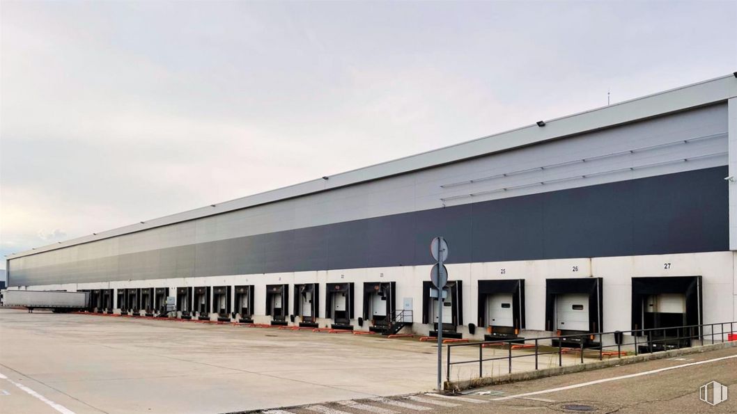
- Maximum free height of 11.60 meters and 26 loading docks
- PCI Medium Risk Level 5
- BREEAM Good certification in use
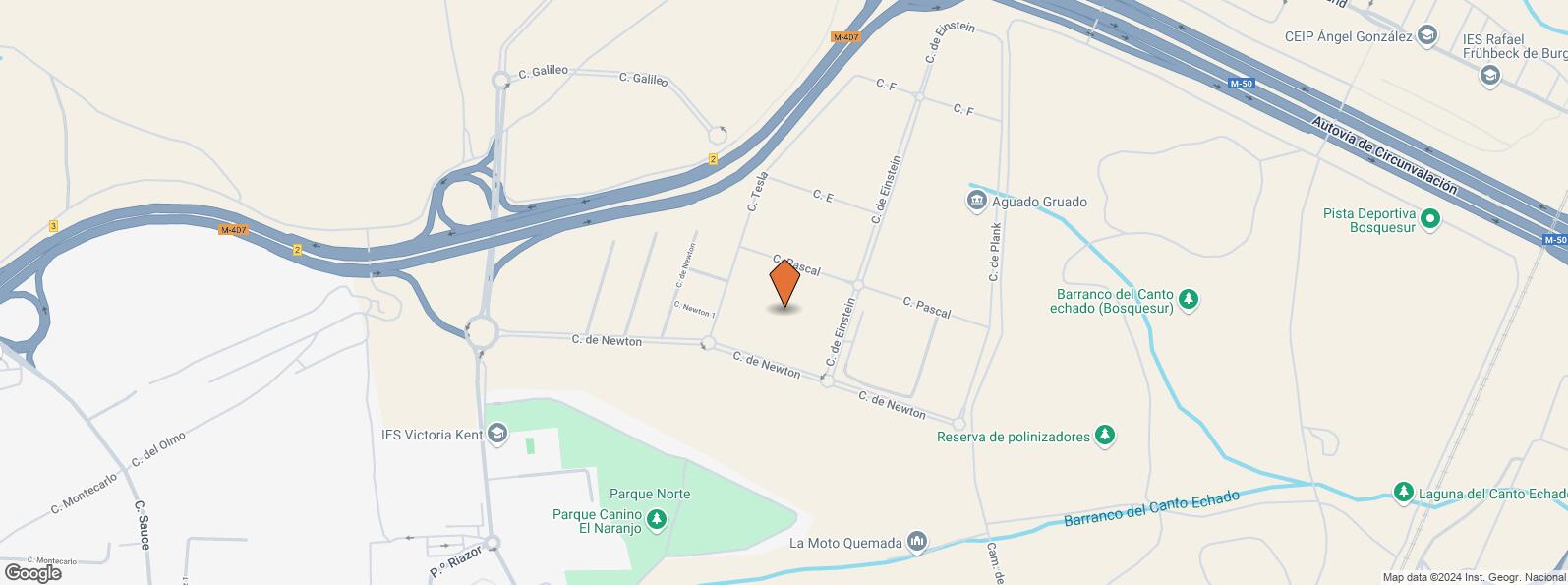
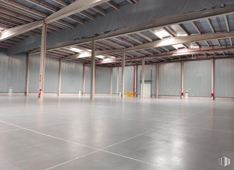
Logistics warehouse of 20,468.51 m2 of total built area, on a plot of 34,113 m2. The plot is close to the M-50 highway (km 56).
The surface is distributed in a module on the ground floor of 16,066.93 m2 (warehouse 1) with two office spaces of 962.95 m2 and a warehouse of 2,475.68 m2 with a ground floor of 18,041 m2 plus a loft of 291.76 m2.
It is located 20 km southwest of Madrid. It consists of a separate logistics building, consisting of offices, two warehouses, with outdoor areas, in a fenced enclosure, with vehicle access and pedestrian access doors.
It is accessed through the following main roads: M-50, M-407 and CM-41. Access to Adolfo Suárez Airport - Madrid Barajas.
The following companies have been established in its immediate environment: GLS, XPOLogistics, Apil, Aguado Gruado, Fiscourier and EBM Mercurio.
Other technical characteristics are:
- Free height under the ridge: 11.60 m.
- Risk Rating: Medium Risk - Grade 5.
- Floor load: 25Mpa.
- 369 parking spaces (26 for trucks and 343 for cars).
- 32 m maneuvering beach
- Precast concrete structure.
- 26 Truck docks.
- Energy certificate C and 70% LED.
- K-22 sprinklers powered by 3 diesel pumps.
- DECK type cover.
- BREEAM Good certification in use.
Immediate availability. One month of grace period per mandatory year.
Spaces
| Floor | Use | m2 | €/mo | €/m2/mo | Space layout | Availability |
|---|---|---|---|---|---|---|
| Property | Industrial | 20,469 | 106,641 | 5.21 | Open Plan | Available now |
Service Charge 8,187 €/mo (0.4 €/m2/mo)
Building info
Amenities
- Office
- Truck Dock
- Bay
- Parking area
- Warehouse
- Parking
- Enclosure closed
Location map
Map loading...Transport
| Commuter train | Line | Distance |
|---|---|---|
| La Serna | C5 | 1 km |
| Parque Polvoranca | C5 | 2 km |
| Fuenlabrada | C5 | 3 km |
| Leganés | C5 | 4 km |
| Transport Node | Distance |
|---|---|
| Estación de Atocha Renfe | 15 km |
| Estación de Madrid-Chamartín | 21 km |
| Aeropuerto Adolfo Suárez-Madrid Barajas | 26 km |
Points of interest
| Commercial areas | Distance |
|---|---|
| C.C. Plaza de las Provincias | 1 km |
| C.C. Arroyosur - Tiendas El Corte Inglés | 2 km |
| Hipercor Arroyo Sur | 2 km |
| Alcampo Fuenlabrada - C.C.Loranca | 2 km |
| Hotels | Distance |
|---|---|
| Hotel LCB Hotel Fuenlabrada **** | 3 km |
| Hotel Barbie * | 4 km |
| Hotel Menoir Dorsett **** | 5 km |
| Public Administration | Distance |
|---|---|
| Oficinas de empleo de Fuenlabrada | 2 km |
| Servicio Común Actos Comunicación y Ejecución - Oficina Decanato | 2 km |
| Ayuntamiento de Fuenlabrada | 2 km |
| Administración de la Agencia Tributaria Fuenlabrada | 3 km |
| Oficinas de empleo de Alcorcón II | 5 km |
| Health | Distance |
|---|---|
| Hospital Universitario Fuenlabrada | 2 km |
| Consultorio de Parque de Miraflores | 3 km |
| Protection and security | Distance |
|---|---|
| Parque de Bomberos de Fuenlabrada | 2 km |
| I.Armas y Explosivos - Fuenlabrada | 2 km |
| Comisaría tramitación de DNI y pasaporte, Oficina de extranjeros - Fuenlabrada | 2 km |
| Policía Local Fuenlabrada | 2 km |
| Base de socorro de la Cruz Roja de Leganés. Avda. Derechos Humanos 2 | 4 km |
| Other points of interest | Distance |
|---|---|
| Gasolinera Carretera M-407, km. 1,800 | 597 m |
| Farmacia Calle Galicia 37, Fuenlabrada | 831 m |
| Farmacia Calle de Ribadeo 23 L-4 y 5, Fuenlabrada | 900 m |
| Parking público. Pabellón Multiusos | 3 km |
| Parking público. Avda. Orellana | 3 km |
Other properties in the Invertica portfolio
- Zona industrialAlovera, Guadalajara 19208Industrial for rent19,850 m2 | Property3.90 €/m2/mo | 77,415 €/mo
- Plataforma Logística CentralIllescas, Toledo 45200Industrial for rent15,156 m2 | Property4.20 €/m2/mo | 63,657 €/mo
- Zona Logística CabanillasCabanillas del Campo, Guadalajara 19171Industrial for rent8,018 m2 | Property3.75 €/m2/mo | 30,068 €/mo
Leganés
Leganés
Popular searches
- Shops in Madrid
- Shops for rent in Madrid
- Warehouse for rent in Madrid
- Offices for rent in Madrid
- Shops for sale in Madrid
- Shops in Madrid city center
- Shops for rent in Alcalá de Henares
- Shops for rent in Leganes
- Shops for rent in Mostoles
- Offices for sale in Madrid
- Warehouse for sale in Madrid
- Warehouses in Madrid
