Industrial for rent 810 m2 | Floor Ground
3,000 €/mo | 3.70 €/m2/mo
- Distributed on two floors
- Good communication by public transport
- Major brands are installed in the area
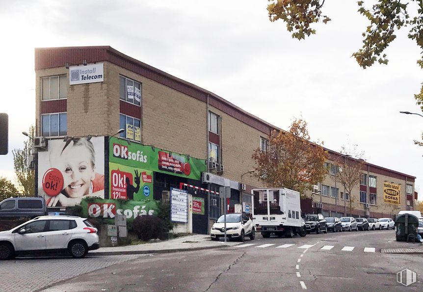
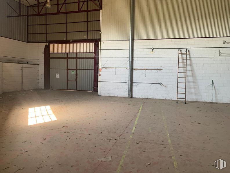
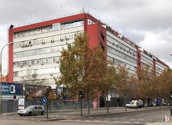
Industrial building with a total area of 810 m2.
It is distributed on a ground floor of 580 m2 and a mezzanine of 230 m2.
It is close to the Megapark shopping center and the Infanta Sofía hospital.
It is in an area where top-tier brands from different sectors operate.
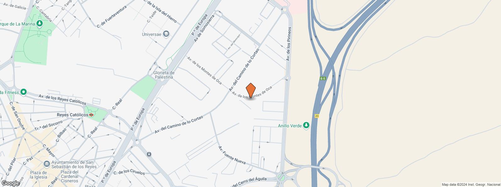
It is well connected by public transport, thanks to the A-1, E-5 and M-50 highways and by public transport it has the metro stations of Hospital Infanta Sofía, Baunatal and Reyes Catolicos (L-10).
Spaces
| Floor | Use | m2 | €/mo | €/m2/mo | Space layout | Availability |
|---|---|---|---|---|---|---|
| Ground | Industrial | 810 | 3,000 | 3.70 | Open Plan | Available now |
Building info
Total Floor: 2Construction year: 1999
Amenities
- Showcase
- Height
- Toilets
- Office
- Gate
- Public Transportation
- Bus stop
- Metro station
- Natural Light - Good
- Warehouse
Location map
Map loading...Contact
Transport
| Bus | Line | Distance |
|---|---|---|
| Av.Camino de Lo Cortao-Av.Fuente Nueva | 7 | 277 m |
| Av.Camino de Lo Cortao-Av.Moncayo | 7 | 348 m |
| Underground | Line | Distance |
|---|---|---|
| Reyes Católicos | 10b | 952 m |
| Hospital Infanta Sofía | 10b | 966 m |
| Baunatal | 10b | 2 km |
| Interurban bus | Line | Distance |
|---|---|---|
| Algete - Pº Europa - Av. Montes de Oca | 171, N103 | 460 m |
| Commuter train | Line | Distance |
|---|---|---|
| Alcobendas-San Sebastián de los Reyes | C1 | 2 km |
| Valdelasfuentes | C1 | 4 km |
| Transport Node | Distance |
|---|---|
| Estación de Madrid-Chamartín | 11 km |
| Aeropuerto Adolfo Suárez-Madrid Barajas | 11 km |
| Estación de Atocha Renfe | 17 km |
Points of interest
| Commercial areas | Distance |
|---|---|
| Parque Comercial - Megapark | 826 m |
| Parque Comercial Megapark | 869 m |
| Carrefour San Sebastián de los Reyes | 980 m |
| C.C. Plaza Norte 2 | 1 km |
| Hotels | Distance |
|---|---|
| Hotel AC San Sebastián de los Reyes **** | 467 m |
| Hotel Sidorme Madrid Aeropuerto T4 **** | 1 km |
| Hotel Miraflores * | 2 km |
| Public Administration | Distance |
|---|---|
| Oficinas de empleo de San Sebastián de los Rey | 836 m |
| Ayuntamiento de San Sebastián de Los Reyes | 1 km |
| INSS - Centros Comarcales - Nº 2 | 3 km |
| TGSS - Administración y Unidad de Recaudación Ejecutiva - Nº 17 | 3 km |
| Oficinas de empleo de Alcobendas | 4 km |
| Health | Distance |
|---|---|
| Hospital Universitario Infanta Sofia | 773 m |
| Centro de Salud V Centenario | 865 m |
| Protection and security | Distance |
|---|---|
| Policía Local San Sebastián de los Reyes | 707 m |
| Parque de Bomberos de Alcobendas | 2 km |
| Comisaría tramitación de DNI y pasaporte, Oficina de extranjeros - Alcobendas | 2 km |
| Base de socorro de la Cruz Roja de Alcobendas. Calle José Echegaray, 18 | 4 km |
| Other points of interest | Distance |
|---|---|
| Gasolinera Avenida Pirineos, 21 | 210 m |
| Farmacia Carretera N-I ( Burgos) km 19, San Sebastián de los Reyes | 973 m |
| Farmacia Avenida de la Plaza de Toros 11, San Sebastián de los Reyes | 981 m |
| Parking público. Pza. Olivares | 1 km |
| Parque de la Marina | 1 km |
| Parking público. Patronato de Deporte Servicios Central | 2 km |
Other properties in the TC Gabinete Inmobiliario portfolio
- Edificio Amura, Calle Cantabria, 2Alcobendas, Madrid 28100Office for rent490 - 2,304 m2 | Floors Ground - 412 - 12.50 €/m2/mo | 5,880 - 28,555 €/mo
- Avenida Tenerife, 2San Sebastián de los Reyes, Madrid 28700Office for rent1,000 m2 | Floor 26 €/m2/mo | 6,000 €/mo

- Edificio Astygi, Calle San Romualdo, 26San Blas - Canillejas, Madrid 28037Office for rent2,082 m2 | Floor 38 €/m2/mo | 16,656 €/mo
San Sebastián de los Reyes
San Sebastián de los Reyes
San Sebastián de los Reyes is a town within the Region of Madrid located 18 kilometres from the capital. It covers a surface area of 59.26 km2 and is commonly known by its abbreviation “Sanse ”. It is located above the River Jarama Valley, at an altitude slightly over 700 metres above sea level. Urban sprawl since the 1960's did away with its rural atmosphere to the extent that it was subsequently absorbed into the capital’s metropolitan area, coinciding with the urban expansion of Alcobendas.
Local call rate
Popular searches
- Shops in Madrid
- Shops for rent in Madrid
- Warehouse for rent in Madrid
- Offices for rent in Madrid
- Shops for sale in Madrid
- Shops in Madrid city center
- Shops for rent in Alcalá de Henares
- Shops for rent in Leganes
- Shops for rent in Mostoles
- Offices for sale in Madrid
- Warehouse for sale in Madrid
- Warehouses in Madrid
Other relevant searches
- Madrid industrial spaces for rent
- Alcobendas industrial spaces for rent
- Algete industrial spaces for rent
- Colmenar Viejo industrial spaces for rent
- Avenida Camino De Lo Cortao industrial spaces for rent
- Calle Lanzarote industrial spaces for rent
- Avenida Fuente Nueva industrial spaces for rent
- Calle Ceuta industrial spaces for rent
