The content of this page has been verified by the Belbex Research team – CoStar Group
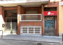
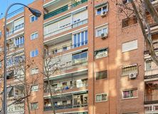
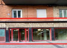
Transfer of a 100 m2 bar located in Ciudad Jardín, Chamartín.
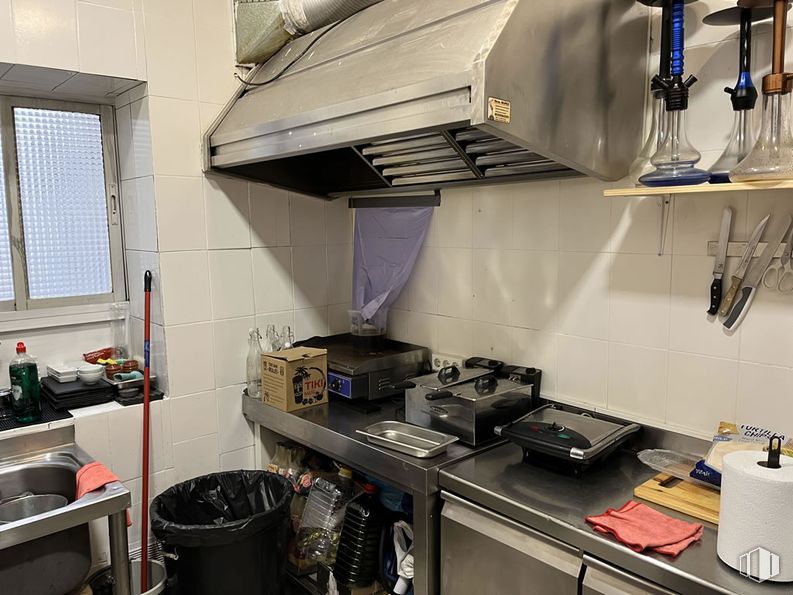
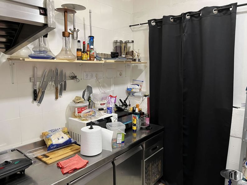
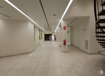
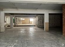
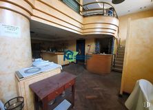
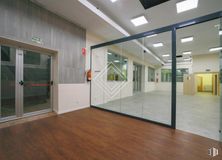
The place has been recently renovated and is still in operation. It has a large bar area with vertical and horizontal bottle racks, a glass washer, a coffee maker and an ice maker. It also has a fully equipped kitchen with smoke outlet to the roof. It has a warehouse and a large interior patio and has a terrace with four tables.
Negotiable transfer.
Spaces
Floor
Use
m2
€/mo
€/m2/mo
Space layout
Availability
Ground
Retail
100
1,400
14
Partitioned
Available now
Last updated 4 weeks ago
Building info
Total Floor: 7Construction year: 1960
Amenities
Smoke extractor
Warehouse
Full equiped Kitchen
Bar
On the street
Terrace
Air Conditioning
Heating
Business for sale
Operating license
Public Transportation
Court yard
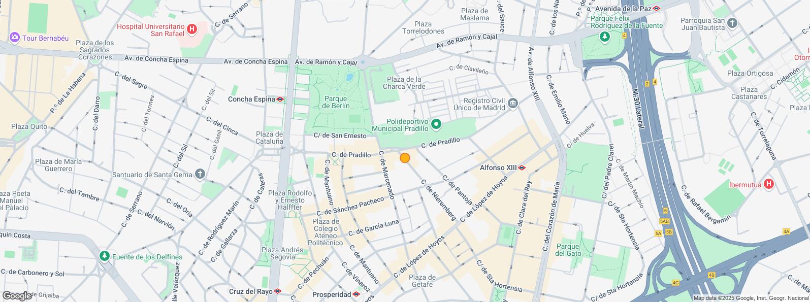
Location map
Map loading...
Contact
Transport
Bus
Line
Distance
Lopez de Hoyos-Pantoja
9, 73, N2
273 m
Lopez de Hoyos-Cardenal Siliceo
9, 73, N2
289 m
Lopez de Hoyos-Eugenio Salazar
9, 73, N2
394 m
Av.Ramon y Cajal-Victor de la Serna
43, 120
404 m
Underground
Line
Distance
Alfonso XIIi
4
400 m
Prosperidad
4
478 m
Concha Espina
9
537 m
Cruz del Rayo
9
629 m
Commuter train
Line
Distance
Nuevos Ministerios
C1, C2, C7, C8, C8a, C8b, C10
2 km
Chamartín
C1, C2, C7, C8, C8a, C8b, C10
3 km
Transport Node
Distance
Intercambiador de Avenida de América
1 km
Estación de Madrid-Chamartín
3 km
Estación de Atocha Renfe
5 km
Aeropuerto Adolfo Suárez-Madrid Barajas
9 km
Taxi
Stop
Distance
Calle de Pradillo, 2
05.32
327 m
Points of interest
Commercial areas
Distance
Mercado Municipal de Prosperidad
421 m
Mercado Municipal de Chamartín
1 km
C.C. La Esquina del Bernabéu
1 km
Alcampo Pio XII
2 km
Hotels
Distance
Hotel Confortel Suites Madrid ****
290 m
Hotel Puerta América ****
874 m
Hotel Hesperia Madrid *****
2 km
Public Administration
Distance
Registro Civil Único
430 m
Junta Municipal de Distrito. Chamartín
580 m
Administración de la Agencia Tributaria Ciudad Lineal
754 m
Audiencia Nacional. Juzgado Central de Menores
809 m
Ayuntamiento de Madrid
4 km
Health
Distance
Centro de Salud Ciudad Jardín
195 m
Hospital Quirón San José
854 m
Protection and security
Distance
Policía Municipal (OAC) Chamartín
581 m
Desto. Especial Madrid Norte
658 m
Comisaría tramitación de DNI y pasaporte - Madrid - Ciudad Lineal
2 km
Parque de Bomberos de Madrid Nº 2. Salamanca. Centro Coordinador
2 km
Base de socorro de la Cruz Roja de Madrid. Avda. Moratalaz 50-52
5 km
Other points of interest
Distance
Farmacia Calle de Marcenado 29, Madrid
98 m
Farmacia Calle de Pradillo 13, Madrid
211 m
Parque de Berlín
387 m
Parking público. Calle Príncipe de Vergara (Auditorio)
Chamartín District is located to the north of Madrid, covering an area of 919.57 hectares and includes the quarters: El Viso, Prosperidad, Ciudad Jardín, Hispanoamérica, Nueva España and Castilla. This district was originally a small village near Madrid Called Chamartín de la Rosa. It borders to the north with Fuencarral - El Pardo, to the east with Ciudad Lineal, to the south with Salamanca District, to the southeast with Chamberí and to the west with Tetuán. One of the main mid and long distance and high speed train stations is located here, namely Chamartín Station, also serving the local railway.