Retail for sale 379 m2 | Floor Ground
2,337,000 € | 6,166 €/m2
- Local with a net return of 4.5%
- Tenant with a long-term contract
- Busy shopping street
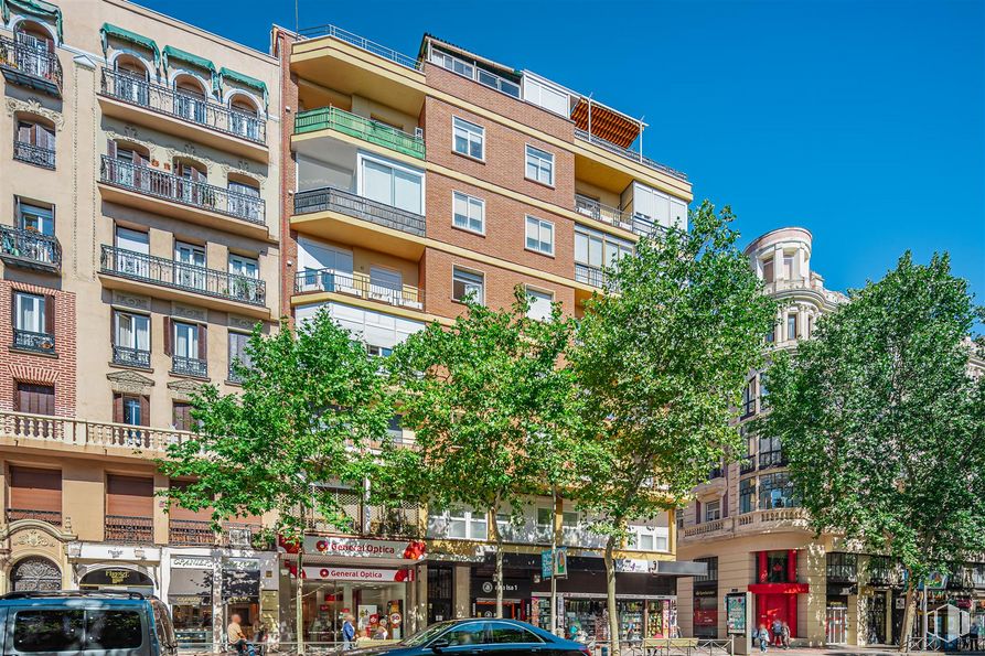
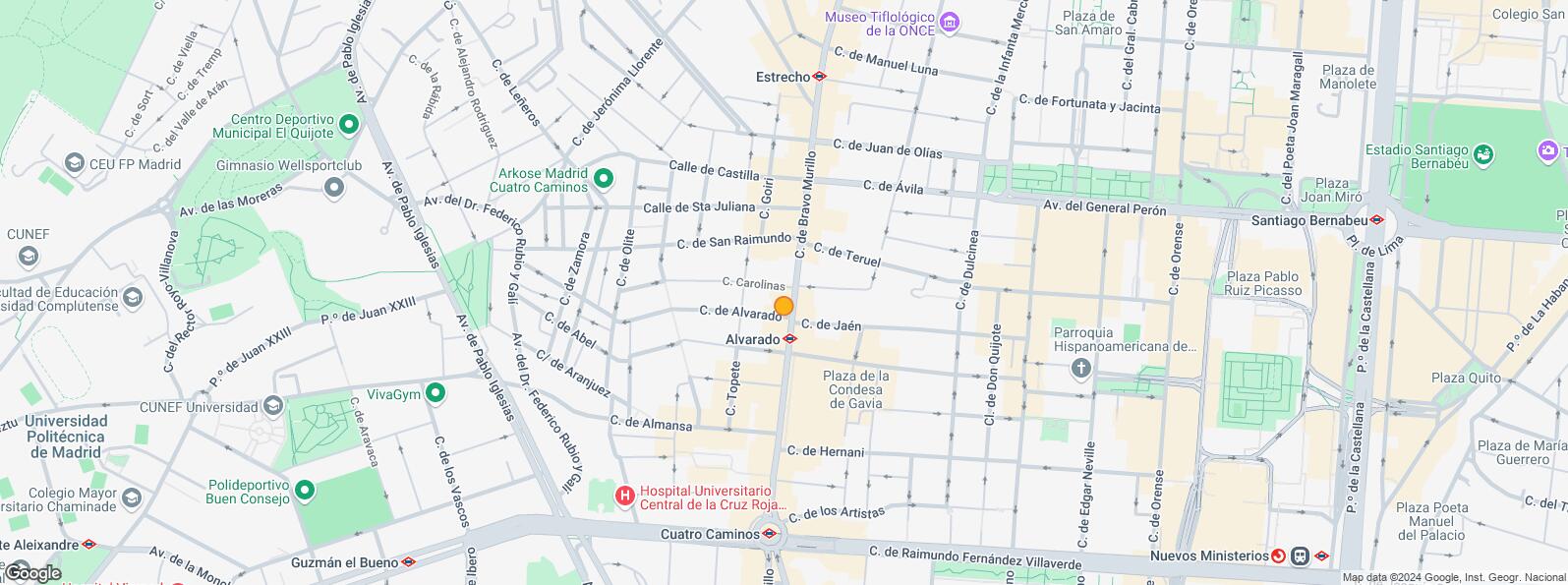
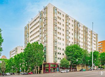
Profitable commercial space located in the Bravo Murillo area, near the Maravillas Market, with a very high pedestrian crossing.
It has 379 m2 built divided into two floors, 182 m2 built on the street level and 197 m2 built commercially in the basement.
It has a façade of 20 linear meters, on the corner of Bravo Murillo and Carnicer streets, so it has excellent visibility.
The place has no smoke outlet.
Spaces
| Floor | Use | m2 | € | €/m2 | Space layout | Availability |
|---|---|---|---|---|---|---|
| Ground | Retail | 379 | 2,337,000 | 6,166 | Open Plan | Available now |
Building info
Total Floor: 8Construction year: 1966
Amenities
- Security locks
- Bathrooms
- Integral lighting
- Warehouse
- High ceilings
- Stairs
- Facade lineal meters
- Corner located
- At several heights
- Showcase
- Load/unload area
- Climate control
- Elevator
- Natural lighting
- Bus stop
- Public Transportation
- In profitability
Location map
Map loading...Contact
Transport
| Bus | Line | Distance |
|---|---|---|
| Bravo Murillo-Almansa | 3, 64, 66, 124, 128, N23 | 34 m |
| Bravo Murillo-Palencia | 3, 64, 66, 124, 128, N23 | 46 m |
| Bravo Murillo-Carolinas | 3, 64, 66, 124, 128 | 232 m |
| Bravo Murillo-Teruel | 3, 64, 66, 124, 128 | 266 m |
| Underground | Line | Distance |
|---|---|---|
| Alvarado | 1 | 66 m |
| Cuatro Caminos | 1, 2, 6 | 266 m |
| Estrecho | 1 | 590 m |
| Ríos Rosas | 1 | 905 m |
| Commuter train | Line | Distance |
|---|---|---|
| Nuevos Ministerios | C1, C2, C7, C8, C8a, C8b, C10 | 1 km |
| Transport Node | Distance |
|---|---|
| Intercambiador de Nuevos Ministerios | 1 km |
| Estación de Madrid-Chamartín | 3 km |
| Estación de Atocha Renfe | 5 km |
| Aeropuerto Adolfo Suárez-Madrid Barajas | 11 km |
| Taxi | Stop | Distance |
|---|---|---|
| Calle de Santa Engracia, 177 | 07.47 | 373 m |
| BiciMAD | Distance |
|---|---|
| Calle de Santa Engracia, 168 | 319 m |
Points of interest
| Commercial areas | Distance |
|---|---|
| Mercado Municipal de Maravillas | 58 m |
| Mercado Municipal de San Enrique | 812 m |
| Gran Almacén El Corte Inglés (Castellana) | 936 m |
| C.C. Moda Shopping | 1 km |
| Hotels | Distance |
|---|---|
| Hotel Gran Atlanta Madrid **** | 518 m |
| Hotel Hesperia Madrid ***** | 2 km |
| Hotel Miguel Ángel ***** | 2 km |
| Public Administration | Distance |
|---|---|
| Consulado de la República Ruandesa | 505 m |
| Servicios Centrales Agencia Tributaria | 573 m |
| Consulado de la República de Liberia | 778 m |
| Junta Municipal de Distrito. Chamberí | 2 km |
| Ayuntamiento de Madrid | 4 km |
| Health | Distance |
|---|---|
| Hospital Central de La Cruz Roja S. José y Santa Adela | 362 m |
| Centro de Salud Reina Victoria | 397 m |
| Protection and security | Distance |
|---|---|
| Policía Municipal (OAC) Chamberí | 316 m |
| Jefatura Agrupacion de Trafico | 730 m |
| Parque de Bomberos de Madrid Nº 1. Chamberí | 1 km |
| Comisaría General Extranjería y Fronteras, Oficina de Extranjero - Madrid | 1 km |
| Other points of interest | Distance |
|---|---|
| Farmacia Calle de Almansa 11, Madrid | 82 m |
| Farmacia Calle de Palencia 2, Madrid | 109 m |
| Parking mixto. Pza. de Condesa de Gavia | 161 m |
| Parking mixto. Calle Hernani | 717 m |
| Gasolinera Calle Rios Rosas, 1 | 774 m |
| Parque de la Dehesa de la Villa | 2 km |
Other properties in the Urbagesa portfolio
- Chueca-JusticiaCentro, Madrid 28004Retail for sale485 m2 | Floor Ground5,155 €/m2 | 2,500,000 €
- Zona UniversidadCentro, Madrid 28015Retail for sale91 m2 | Floor Ground7,912 €/m2 | 720,000 €
- Retiro - EstrellaRetiro, Madrid 28009Retail for sale321 m2 | Floor Ground3,059 €/m2 | 981,818 €
Tetuán
Tetuán
Tetuán District covers an area of 537.31 hectares and includes the quarters Bellas Vistas, Cuatro Caminos, Castillejos, Almenara, Valdeacederas and Berruguete. It borders with the districts of Fuencarral - El Pardo to the north, Chamartín to the east, Chamberí to the south and to the west with Moncloa - Aravaca. It is one of the most mixed areas in the city and is one of the most relevant business areas: Azca.
Local call rate
Popular searches
- Shops in Madrid
- Shops for rent in Madrid
- Warehouse for rent in Madrid
- Offices for rent in Madrid
- Shops for sale in Madrid
- Shops in Madrid city center
- Shops for rent in Alcalá de Henares
- Shops for rent in Leganes
- Shops for rent in Mostoles
- Offices for sale in Madrid
- Warehouse for sale in Madrid
- Warehouses in Madrid
