Industrial for sale450 - 900 m2 | Floors 4 - 5 Price upon request
Versatile space
Building in good condition
Excellent communication with transport
Verified Listing
The content of this page has been verified by the Belbex Research team – CoStar Group
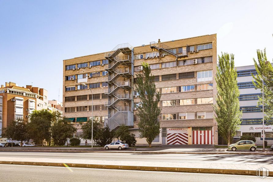
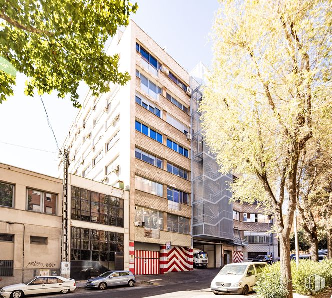
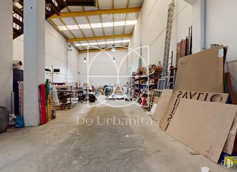
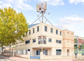
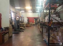
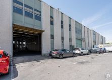
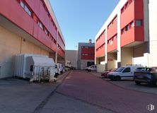
Warehouses are sold in the Almendrales area of Madrid.
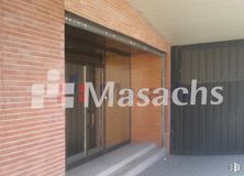
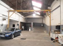
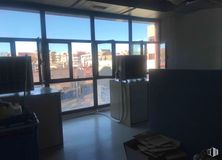
They each have a total area of 450 m2 and are located on the 4th and 5th floors of an industrial building. These are very bright and diaphanous warehouses that offer different distribution options. They have a forklift system and several entrances. The building is under surveillance. Highlight its location in a sought-after area with excellent transport links.
Spaces
Floor
Use
m2
€
€/m2
Space layout
Availability
4
Industrial
450
TBC
TBC
Open Plan
Available now
5
Industrial
450
TBC
TBC
Open Plan
Available now
Last updated 3 months ago
Building info
Total Floor: 7Construction year: 1975 5 Parking Space(s) Included
Amenities
Toilets
Natural lighting
Lift
Load/unload area
Public Transportation
Bus stop
Cement/concrete facade
24 hour security
Parking
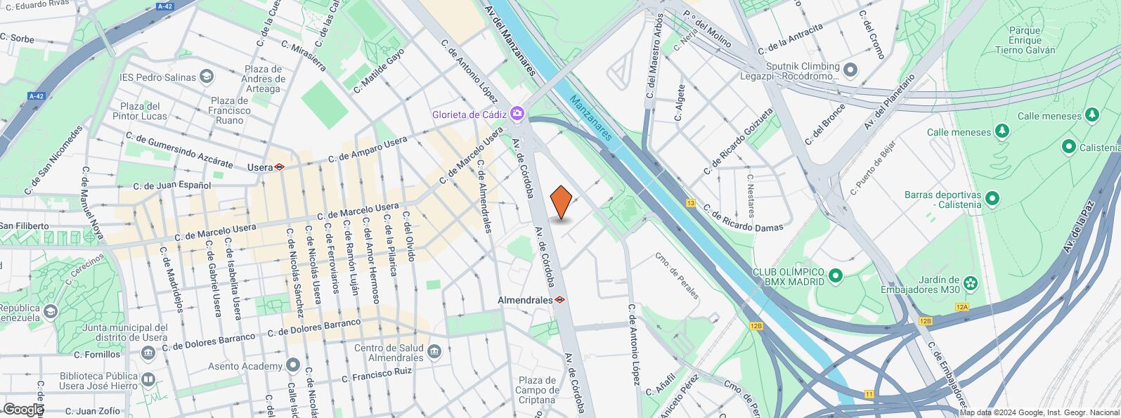
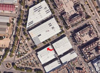
Location map
Map loading...
Contact
Transport
Bus
Line
Distance
Av.Cordoba Nº 19
18, 22, 59, 76, 79, 85, 86, N13, N14
134 m
Antonio Lopez-Av.Cordoba
23, 123, N12
157 m
Av.Cordoba-Piedrabuena
18, 22, 59, 76, 79, 85, 86, N13, N14
172 m
Santuario-San Antonio Padua
6, 78
188 m
Underground
Line
Distance
Almendrales
3
155 m
Legazpi
3, 6
627 m
Usera
6
682 m
Interurban bus
Line
Distance
Valdemoro - Av. Cordoba - Gta. Cadiz
422, 424, N401
207 m
Commuter train
Line
Distance
Doce de Octubre
C5
728 m
Delicias
C1, C7, C10
2 km
Méndez Alvaro
C1, C5, C7, C10
2 km
Orcasitas
C5
2 km
Transport Node
Distance
Área Intermodal de Legazpi
594 m
Estación de Atocha Renfe
2 km
Estación de Madrid-Chamartín
10 km
Aeropuerto Adolfo Suárez-Madrid Barajas
14 km
Taxi
Stop
Distance
Calle de Antonio Lopez, 174
12.05
348 m
Points of interest
Commercial areas
Distance
Mercado Municipal de Jesús del Gran Poder
283 m
Alcampo Madrid Río
640 m
C.C. Plaza Río 2
645 m
Mercado Municipal de Usera
720 m
Hotels
Distance
Hotel Isis **
395 m
Hotel Praga ****
1 km
Rafael Hoteles Atocha ****
2 km
Public Administration
Distance
Administración de la Agencia Tributaria Villaverde-Usera
190 m
Oficinas de empleo de Usera
403 m
Junta Municipal de Distrito. Arganzuela
825 m
Consejería de Economía, Empleo y Hacienda
2 km
Ayuntamiento de Madrid
4 km
Health
Distance
Centro de Salud Almendrales
493 m
Hospital Universitario 12 de Octubre
1 km
Protection and security
Distance
Parque de Bomberos de Madrid Nº 5. Usera
1 km
Comisaría tramitación de DNI y pasaporte - Madrid - Usera - Villaverde 2
1 km
Policía Municipal (OAC) Arganzuela
1 km
Centro de Inserción Social Victoria Kent
1 km
Cía. de Conducciones Especiales (UPROSE)/C.U.E./A.R.S/S.M.M/Cía de Embajadas/Cía de Seg. Penitenciaria/Cía de Escoltas.
2 km
Other points of interest
Distance
Farmacia Calle de Antonio López 202, Madrid
128 m
Farmacia Calle de Santuario 1, Madrid
192 m
Gasolinera Calle Antonio López, 244
355 m
Parking mixto. Calle Ortiz Campos
799 m
Invernadero del Palacio de Cristal de la Arganzuela
Usera District is one of Madrid’s 21 districts, administratively arranged in the following quarters: Orcasitas, Orcasur, San Fermín, Almendrales, Moscardó, Zofío and Pradolongo. It covers a surface of 770.28 hectares and it is delimited by the River Manzanares, Puente de Praga, Paseo de Santa María de la Cabeza, Plaza de Fernández Ladreda, roads A-42 and M-40. It borders to the west and nothwest with Carabanchel, to the northeast with Arganzuela, to the east with Puente de Vallecas, and to the south with Villaverde District.