Retail for sale 190 m2 | Floor Ground
169,000 € | 889 €/m2
- Large, bright and visible space
- Consolidated and transited area
- Good communications
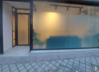
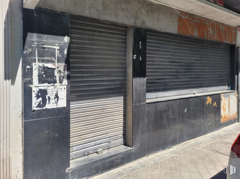
Commercial space located at street level, bright and visible.
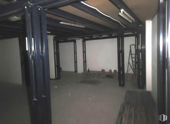
It has 190 m2 distributed over two floors:
- Ground floor of 95 m2.
- Basement of 95 m2.
It has two toilets, shop window, air conditioning and electric shutter at the front door and window.
Spaces
| Floor | Use | m2 | € | €/m2 | Space layout | Availability |
|---|---|---|---|---|---|---|
| Ground | Retail | 190 | 169,000 | 889 | Partitioned | Available now |
Building info
Total Floor: 4Construction year: 1970
Amenities
- Smoke extractor
- Security locks
- Stairs
- On the street
- At several heights
- Showcase
- Natural lighting
- Bus stop
- Public Transportation
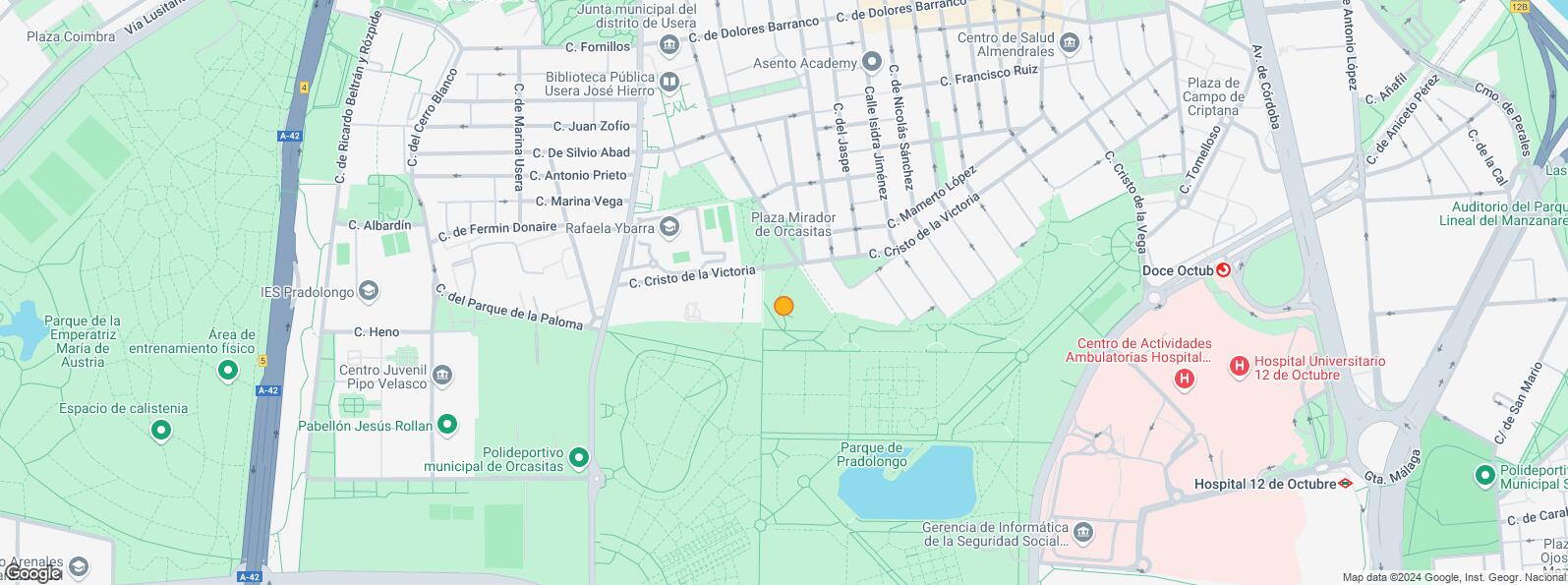
Location map
Map loading...Contact
Transport
| Bus | Line | Distance |
|---|---|---|
| Cristo Victoria-Jaspe | 78 | 200 m |
| Av.Rafaela Ybarra-Marina Vega | 6, 60, 81 | 301 m |
| Pza.Del Hidrogeno | 6 | 343 m |
| Av.Rafaela Ybarra-Dolores Barranco | 6, 60, 81, N15 | 351 m |
| Underground | Line | Distance |
|---|---|---|
| Usera | 6 | 890 m |
| Almendrales | 3 | 962 m |
| Plaza Elíptica | 6, 11 | 998 m |
| Commuter train | Line | Distance |
|---|---|---|
| Doce de Octubre | C5 | 772 m |
| Orcasitas | C5 | 1 km |
| Pirámides | C1, C7, C10 | 3 km |
| Delicias | C1, C7, C10 | 3 km |
| Transport Node | Distance |
|---|---|
| Intercambiador de Plaza Elíptica | 1 km |
| Estación de Atocha Renfe | 3 km |
| Estación de Madrid-Chamartín | 10 km |
| Aeropuerto Adolfo Suárez-Madrid Barajas | 15 km |
Points of interest
| Commercial areas | Distance |
|---|---|
| Mercado Municipal de Usera | 816 m |
| Mercado Municipal de Jesús del Gran Poder | 924 m |
| C.C. Plaza Río 2 | 1 km |
| Alcampo Madrid Río | 1 km |
| Hotels | Distance |
|---|---|
| Hotel Praga **** | 2 km |
| Rafael Hoteles Atocha **** | 3 km |
| Public Administration | Distance |
|---|---|
| Junta Municipal de Distrito. Usera | 363 m |
| INSS - Centros Urbanos - Nº 15 | 623 m |
| Oficinas de empleo de Usera | 918 m |
| Administración de la Agencia Tributaria Villaverde-Usera | 927 m |
| Ayuntamiento de Madrid | 5 km |
| Health | Distance |
|---|---|
| Centro de Salud Joaquín Rodrigo | 224 m |
| C.E. Orcasitas | 968 m |
| Protection and security | Distance |
|---|---|
| Comisaría tramitación de DNI y pasaporte - Madrid - Usera - Villaverde 2 | 131 m |
| Policía Municipal (OAC) Usera | 698 m |
| Parque de Bomberos de Madrid Nº 5. Usera | 1 km |
| SEPRONA/I.C.A.E./Zona de Madrid | 2 km |
| Centro de Inserción Social Victoria Kent | 2 km |
| Other points of interest | Distance |
|---|---|
| Farmacia Calle de San Basilio 24, Madrid | 6 m |
| Farmacia Calle de Miramadrid 18, Madrid | 188 m |
| Parque de Pradolongo | 505 m |
| Parking mixto. Calle Ortiz Campos | 587 m |
| Gasolinera Avenida de los Poblados, 167 | 812 m |
| Parque Sur | 1 km |
Other properties in the Aseguramos Tu Alquiler portfolio
- Calle ProvisionesCentro, Madrid 28012Retail for sale614 m2 | Floor Ground1,075 €/m2 | 659,900 €

- Calle Batalla SaladoArganzuela, Madrid 28045Retail for rent280 m2 | Floor Ground13.39 €/m2/mo | 3,750 €/mo

Usera
Usera
Usera District is one of Madrid’s 21 districts, administratively arranged in the following quarters: Orcasitas, Orcasur, San Fermín, Almendrales, Moscardó, Zofío and Pradolongo. It covers a surface of 770.28 hectares and it is delimited by the River Manzanares, Puente de Praga, Paseo de Santa María de la Cabeza, Plaza de Fernández Ladreda, roads A-42 and M-40. It borders to the west and nothwest with Carabanchel, to the northeast with Arganzuela, to the east with Puente de Vallecas, and to the south with Villaverde District.
Local call rate
Popular searches
- Shops in Madrid
- Shops for rent in Madrid
- Warehouse for rent in Madrid
- Offices for rent in Madrid
- Shops for sale in Madrid
- Shops in Madrid city center
- Shops for rent in Alcalá de Henares
- Shops for rent in Leganes
- Shops for rent in Mostoles
- Offices for sale in Madrid
- Warehouse for sale in Madrid
- Warehouses in Madrid


