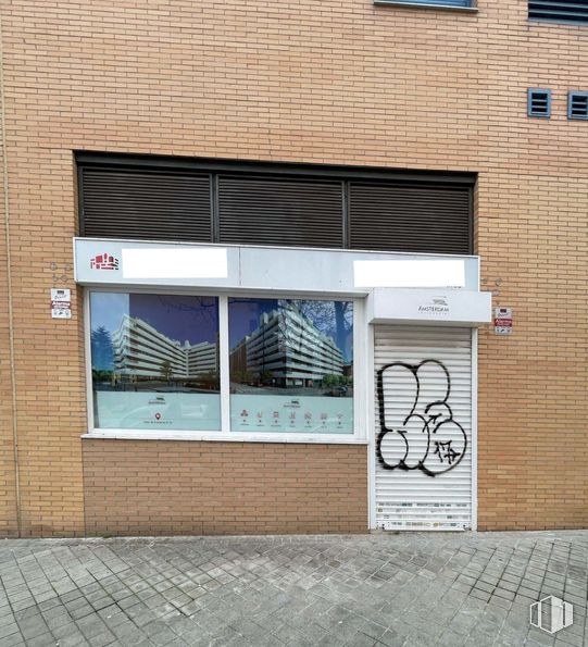
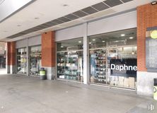
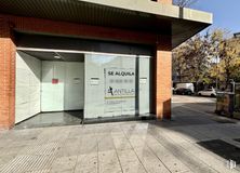
The location is great. Transit area with businesses in the area
Verified Listing
The content of this page has been verified by the Belbex Research team – CoStar Group
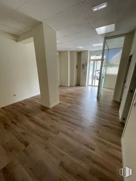
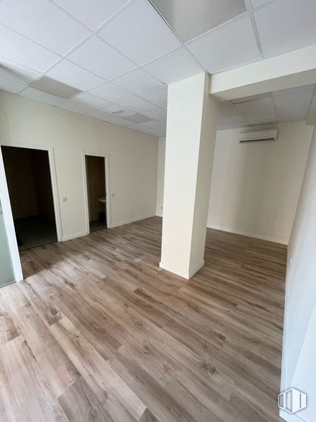
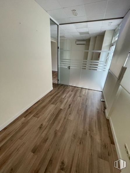
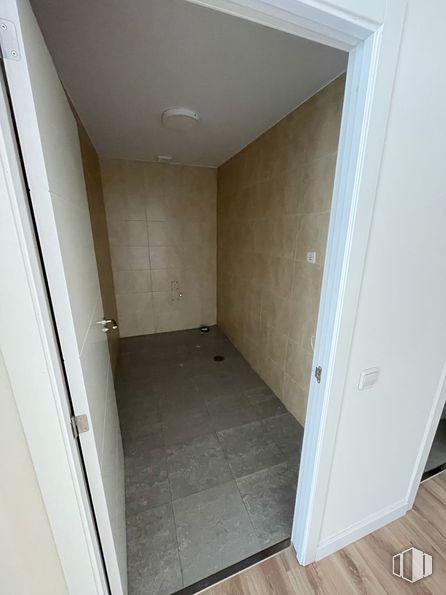
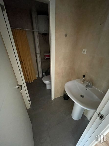
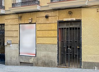
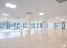
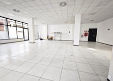
It has an entrance-reception, two offices and two bathrooms, one suitable for the disabled and a warehouse. Pre-installation of air conditioning.
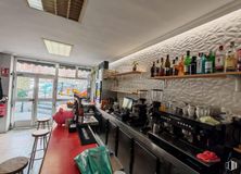
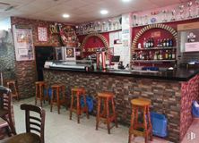
The place can be adapted to the needs of any type of commercial activity and for any type of business.
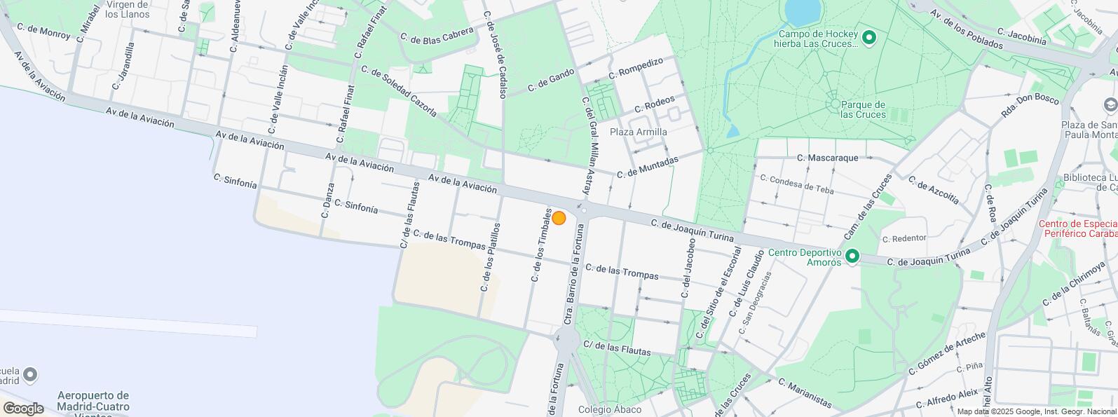
It is well connected by public transport, thanks to several urban and interurban bus lines that connect with municipalities in the area, such as Leganés.
Spaces
Floor
Use
m2
€/mo
€/m2/mo
Space layout
Availability
Ground
Retail
76
1,200
15.79
Divided
Available now
New
Building info
Total Floor: 8Construction year: 2004
Amenities
Toilets
Handicaped Bathrooms/toilets
Warehouse
On the street
Showcase
Natural lighting
Bus stop
Public Transportation
Renovated
Location map
Map loading...
Contact
Transport
Bus
Line
Distance
Av.Aviacion-Jose Cadalso
N19
78 m
Ctra.Barrio de la Fortuna-Av.Aviacion
155
168 m
Crta.Barrio de la Fortuna-Joaquin Turina
155
221 m
Gral.Millan Astray-Gral.Saliquet
34, 155, N19
227 m
Interurban bus
Line
Distance
Leganes - Ctra. Barrio de la Fortuna - Av. Aviacion
483, 486, 487, N802
175 m
Madrid - Ctra. Barrio la Fortuna - Joaquin Turina
483, 486, 487, N802
197 m
Leganes - Gral. Millan Astray - Gral. Saliquet
483, 487
232 m
Commuter train
Line
Distance
Fanjul
C5
1 km
Las Águilas
C5
1 km
Aluche
C5
2 km
Cuatro Vientos
C5
2 km
Transport Node
Distance
Intercambiador de Aluche
2 km
Estación de Atocha Renfe
8 km
Estación de Madrid-Chamartín
13 km
Aeropuerto Adolfo Suárez-Madrid Barajas
19 km
Points of interest
Commercial areas
Distance
Mercado Municipal de Las Águilas
500 m
C.C. Plaza Aluche
1 km
Carrefour Aluche
1 km
C.C. Sambil Oulet
2 km
Public Administration
Distance
Servicio Común Actos Comunicación y Ejecución
833 m
Junta Municipal de Distrito. La Latina
1 km
Administración de la Agencia Tributaria Suroeste
2 km
Ayuntamiento de Leganés
5 km
Health
Distance
Centro de Salud Las Águilas I y II
510 m
Sanatorio Esquerdo, S.A.
1 km
Protection and security
Distance
Policía Municipal (OAC) Latina
722 m
Comisaría tramitación de DNI y pasaporte, Oficina de extranjeros - Madrid - Latina
1 km
Parque de Bomberos de Madrid Nº 12. Latina
2 km
Base de socorro de la Cruz Roja de Alcorcón. Avenida de los Castillos 3
4 km
Other points of interest
Distance
Farmacia Carretera del Barrio de la Fortuna, Madrid
La Latina District covers an area of 2,542.97 hectares and runs parallel to the Extremadura road to the southwest of the capital. It borders with the districts of Carabanchel, Arganzuela, Centro and Moncloa - Aravaca and includes the quarters of Los Cármenes, Puerta del Ángel, Lucero, Aluche, Campamento, Cuatro Vientos and Las Águilas. Latina District must not be confused with La Latina Quarter, which is located inside the Central District. They share the same name because both of them are named after Beatriz Galindo, La Latina, a humanist who was a friend of Isabella I of Castile, and hence her nickname La Latina. The Bridge of Segovia, which joins the historical centre with the southeast of Madrid was built in 1574 during the reign of Felipe I. It is the work of the architects Gaspar de Vega and Juan de Herrera.