The content of this page has been verified by the Belbex Research team – CoStar Group
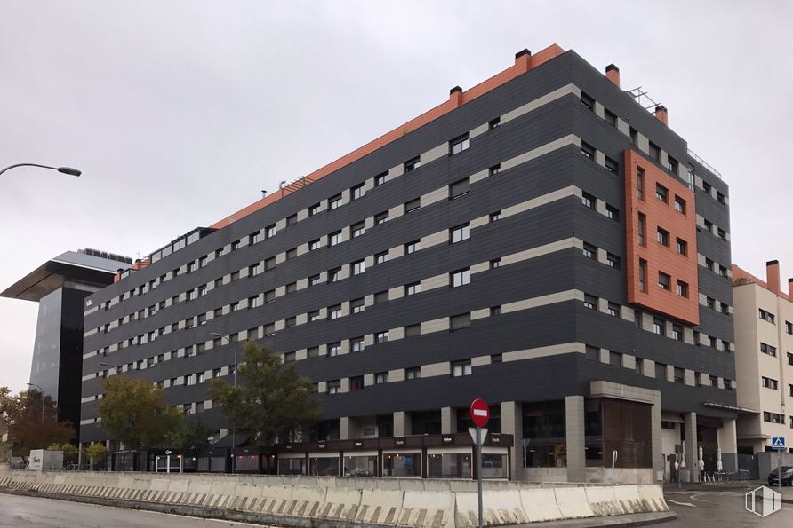
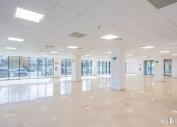
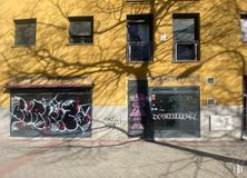
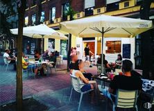
Fantastic commercial space with an area of 358 m2. It is located on Mezquite Street, on the corner, on the ground floor of a residential building.
One of its many possibilities is that of restoration, since the place consists of a smoke outlet and its last license was for this purpose. In addition, it has a terrace for 15 tables.
The place is distributed on two floors and has large windows on a façade of about 30 linear meters.
Spaces
Floor
Use
m2
€/mo
€/m2/mo
Space layout
Availability
Ground
Retail
358
7,495
20.94
Partitioned
Available now
Last updated 2 weeks ago
Building info
Total Floor: 9Construction year: 2008
Amenities
Smoke extractor
Toilets
Warehouse
Full equiped Kitchen
Bar
Stairs
Corner located
On the street
At several heights
Terrace
Showcase
Operating license
Elevator
Bus stop
Public Transportation
Natural Light - Good
Metro station
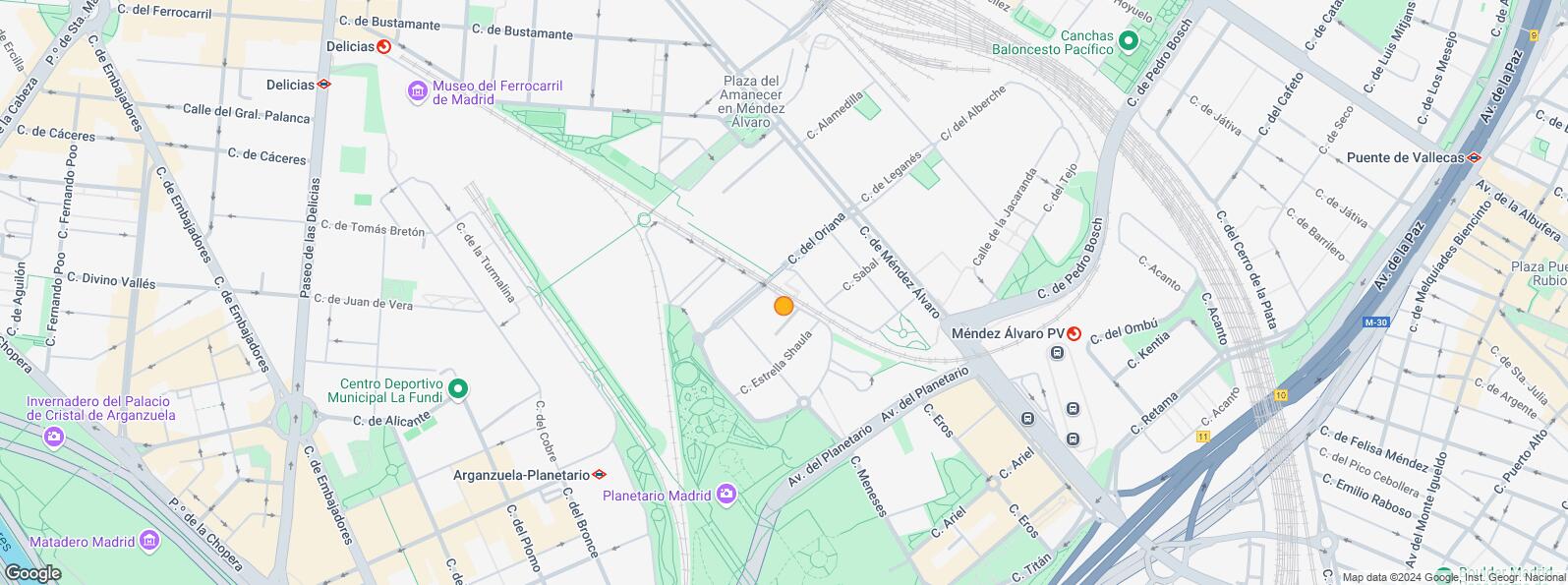
Location map
Map loading...
Contact
Transport
Bus
Line
Distance
Mendez Alvaro-Oriana
8
112 m
Mendez Alvaro-Meneses
8, 102, 152, N11
170 m
Mendez Alvaro-Pedro Bosch
8, 102, 152, N11
172 m
Mendez Alvaro Nº 57
8, 102, 152, N11
191 m
Underground
Line
Distance
Méndez Alvaro
6
323 m
Arganzuela Planetario
6
620 m
Pacífico
1, 6
855 m
Menéndez Pelayo
1
875 m
Interurban bus
Line
Distance
Madrid - Estación Sur de Autobuses
418, 419, 423, 536
469 m
Commuter train
Line
Distance
Méndez Alvaro
C1, C5, C7, C10
411 m
Delicias
C1, C7, C10
1 km
Atocha
C1, C2, C3, C4, C5, C7, C8, C8a, C8b, C10
1 km
Embajadores
C5
2 km
Transport Node
Distance
Estación de Autobuses de Méndez Álvaro
476 m
Estación de Atocha Renfe
1 km
Estación de Madrid-Chamartín
8 km
Aeropuerto Adolfo Suárez-Madrid Barajas
12 km
Taxi
Stop
Distance
Calle de Mendez Alvaro, 44
02.24
220 m
Points of interest
Commercial areas
Distance
Hipercor Méndez Álvaro
608 m
C.C. Méndez Álvaro - Tiendas El Corte Inglés
619 m
Mercado Municipal de Pacífico
1 km
Mercado Municipal de Guillermo de Osma
1 km
Hotels
Distance
Rafael Hoteles Atocha ****
611 m
Hotel AC Atocha ****
1 km
Hotel Ritz Madrid *****
2 km
Public Administration
Distance
Consejería de Economía, Empleo y Hacienda
644 m
Consejería de Economía, Empleo y Hacienda
644 m
Junta Municipal de Distrito. Retiro
799 m
Administración de Aduanas Madrid - Ferrocarril
899 m
Mº de Agricultura, Pesca y Alimentación
1 km
Health
Distance
Centro de Salud Adelfas
857 m
C.E. Peña Prieta - Hermanos Sangró
1 km
Protection and security
Distance
Comisaría - Madrid - Estación Sur de Autobuses
427 m
Unidad de Madres Jaime Garralda
591 m
Policía Municipal (OAC) Retiro
613 m
Sección Aduanas de Abroñigal
848 m
Parque de Bomberos de Madrid Nº 5. Usera
2 km
Other points of interest
Distance
Farmacia Calle de Méndez Álvaro 64 A, Madrid
171 m
Farmacia Calle de Nebulosas 2, Madrid
283 m
Gasolinera Calle Méndez Álvaro, 83 (Estación Sur de Autobuses)
362 m
Parque Enrique Tierno Galván (Madrid)
523 m
Parking público. Estación Ferroviaria de Atocha
1 km
Invernadero - Jardín Tropical de la Estación Puerta de Atocha
Arganzuela district is located to the east of the River Manzanares, inside the perimeter of the M-30. It covers an area of 655.21 hectares and consists of the Imperial, Acacias, Chopera, Legazpi, Delicias, Palos de Moguer and Atocha quarters. It borders to the north and northeast with the Centro and Retiro quarters, to the east and southeast with the Puente de Vallecas quarter, to the south with the Usera quarter and to the west with Latina and Carabanchel quarters. One of the attractions of Arganzuela is Madrid Río park, one of Madrid’s most outstanding green, recreational areas. Another of the most visited cultural sites in the district is Matadero, a former abattoir in Madrid that was converted into a number of Neo-Mudejar style pavilions in the early 20th century. It is located on the banks of the River Manzanares and features different spaces used for cultural events and exhibits.