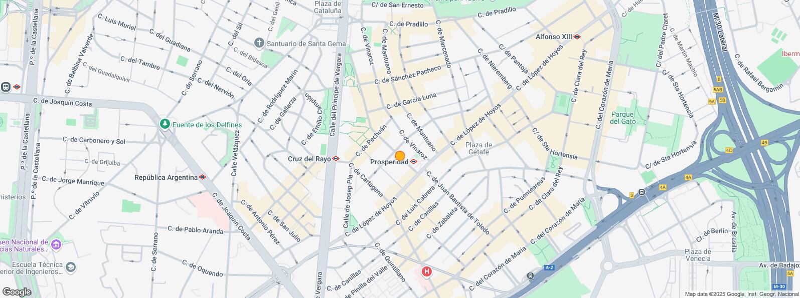
Calle López Hoyos Chamartín, Madrid 28002


Retail for rent 260 m2 | Floor Ground
4,600 €/mo | 17.69 €/m2/mo
- Shopping area in López de Hoyos
- Good connections by public and private transport
- In good condition
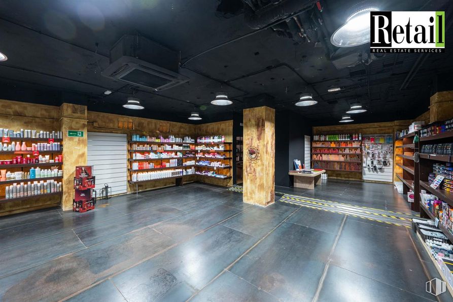
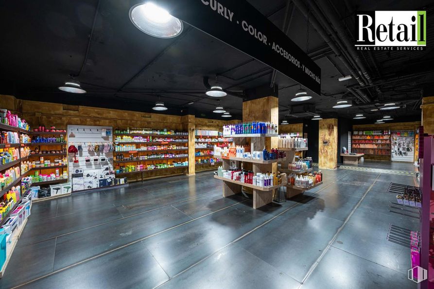
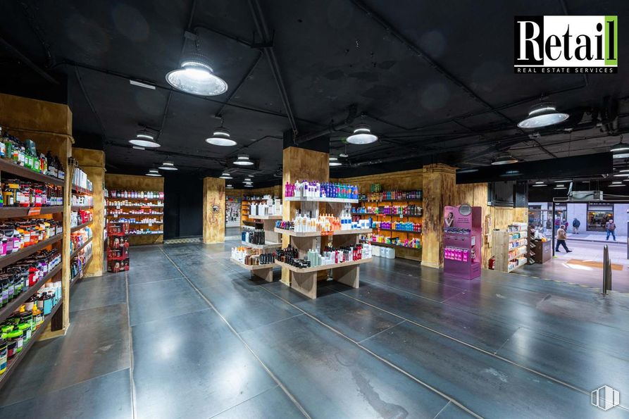
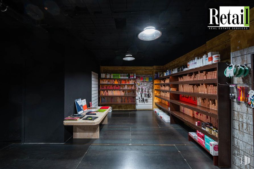
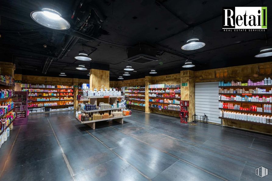
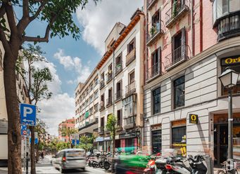
Available commercial space located on Calle López de Hoyos, a few meters from Príncipe de Vergara, in the district of Chamartín. It is located in a commercial area of Madrid with high pedestrian traffic and road traffic, which guarantees high visibility and business potential.
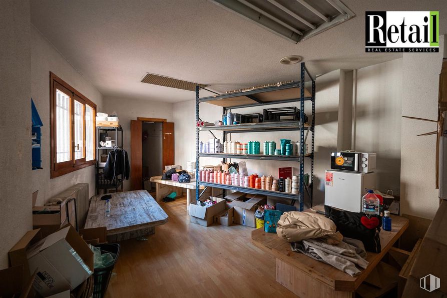
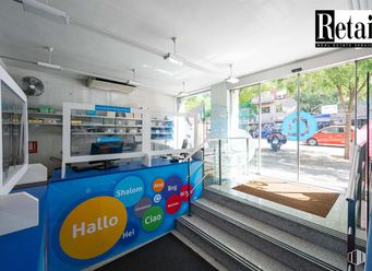
The premises have a total built area of 260 m2, with a wide façade of 8 linear meters, providing excellent exposure. The height is 4.5 meters, which provides spaciousness and luminosity to the space, which is completely open plan, allowing a flexible distribution according to business needs. There is no smoke outlet.
Spaces
| Floor | Use | m2 | €/mo | €/m2/mo | Space layout | Availability |
|---|---|---|---|---|---|---|
| Ground | Retail | 260 | 4,600 | 17.69 | Open Plan | Available now |
Building info
Total Floor: 8Construction year: 1978
Amenities
- High ceilings
- Facade lineal meters
- On the street
- Central heating
- Commissionaire service
- Parking
- Bus stop
- Public Transportation
- Natural Light - Good
Location map
Map loading...Contact
Transport
| Bus | Line | Distance |
|---|---|---|
| Lopez de Hoyos-Cartagena | 9, 73, N2 | 4 m |
| Cartagena-Lopez de Hoyos | 1 | 44 m |
| Lopez de Hoyos-Pza.Prosperidad | 1, 9, 73, N2 | 193 m |
| Suero de Quiñones-Pechuan | 1 | 236 m |
| Underground | Line | Distance |
|---|---|---|
| Prosperidad | 4 | 159 m |
| Cruz del Rayo | 9 | 297 m |
| Cartagena | 7 | 518 m |
| Avda. de América | 4, 6, 7, 9 | 605 m |
| Interurban bus | Line | Distance |
|---|---|---|
| Madrid - Intercambiador de Avenida América | 222, 223, 224, 226, 227, 229, 261, 281, 282, 283, 284, 224A, VAC-044 | 500 m |
| Commuter train | Line | Distance |
|---|---|---|
| Nuevos Ministerios | C1, C2, C7, C8, C8a, C8b, C10 | 1 km |
| Recoletos | C1, C2, C7, C8, C8a, C8b, C10 | 3 km |
| Transport Node | Distance |
|---|---|
| Intercambiador de Avenida de América | 535 m |
| Estación de Madrid-Chamartín | 3 km |
| Estación de Atocha Renfe | 4 km |
| Aeropuerto Adolfo Suárez-Madrid Barajas | 9 km |
| Taxi | Stop | Distance |
|---|---|---|
| Calle de Suero de Quiñones, S/N | 05.55 | 130 m |
| BiciMAD | Distance |
|---|---|
| Calle de Maria Francisca, 1 | 310 m |
Points of interest
| Commercial areas | Distance |
|---|---|
| Mercado Municipal de Prosperidad | 215 m |
| Mercado Municipal de Guindalera | 1 km |
| C.C. La Esquina del Bernabéu | 1 km |
| C.C. ABC Serrano | 2 km |
| Hotels | Distance |
|---|---|
| Hotel Abba Madrid **** | 503 m |
| Hotel Puerta América **** | 541 m |
| Hotel Hesperia Madrid ***** | 1 km |
| Public Administration | Distance |
|---|---|
| Embajada de la República de San Marino | 228 m |
| Junta Municipal de Distrito. Chamartín | 301 m |
| Consulado de la República de Bolivia | 347 m |
| Administración de la Agencia Tributaria Maria Molina | 804 m |
| Ayuntamiento de Madrid | 3 km |
| Health | Distance |
|---|---|
| Hospital Quirón San José | 270 m |
| Centro de Salud Príncipe de Vergara | 439 m |
| Protection and security | Distance |
|---|---|
| Policía Municipal (OAC) Chamartín | 299 m |
| Desto. Especial Madrid Norte | 1 km |
| Comisaría - Madrid - Chamberí | 2 km |
| Parque de Bomberos de Madrid Nº 2. Salamanca. Centro Coordinador | 2 km |
| Base de socorro de la Cruz Roja de Madrid. Avda. Moratalaz 50-52 | 4 km |
| Other points of interest | Distance |
|---|---|
| Farmacia Calle de Cartagena 121, Madrid | 143 m |
| Farmacia Calle de Luis Vives 14, Madrid | 160 m |
| Gasolinera Calle Príncipe de Vergara, 134 | 242 m |
| Parking mixto. Avda. America (Intercambiador ) | 457 m |
| Parking público. Calle Príncipe de Vergara (Auditorio) | 604 m |
| Parking público. Museo de la Ciudad | 604 m |
| Parque de Berlín | 865 m |
Other properties in the Retail Real Estate Services portfolio
- Walwo Valdemarín Working, Calle AguarónMoncloa - Aravaca, Madrid 28023Retail for rent275 - 613 m2 | Floor Ground12,000 - 24,000 €/mo
- Calle FuencarralCentro, Madrid 28004Retail for rent80 m2 | Floor Ground137.50 €/m2/mo | 11,000 €/mo
- Calle Santa EngraciaChamberí, Madrid 28003Retail for rent416 m2 | Floor Ground14.18 €/m2/mo | 5,900 €/mo
Chamartín

Chamartín
Chamartín District is located to the north of Madrid, covering an area of 919.57 hectares and includes the quarters: El Viso, Prosperidad, Ciudad Jardín, Hispanoamérica, Nueva España and Castilla. This district was originally a small village near Madrid Called Chamartín de la Rosa. It borders to the north with Fuencarral - El Pardo, to the east with Ciudad Lineal, to the south with Salamanca District, to the southeast with Chamberí and to the west with Tetuán. One of the main mid and long distance and high speed train stations is located here, namely Chamartín Station, also serving the local railway.
Local call rate

Popular searches
- Shops in Madrid
- Shops for rent in Madrid
- Warehouse for rent in Madrid
- Offices for rent in Madrid
- Shops for sale in Madrid
- Shops in Madrid city center
- Shops for rent in Alcalá de Henares
- Shops for rent in Leganes
- Shops for rent in Mostoles
- Offices for sale in Madrid
- Warehouse for sale in Madrid
- Warehouses in Madrid