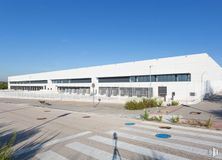

17,570 m2
| Property
Price upon request
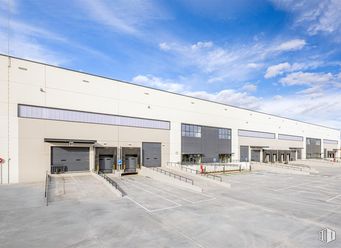
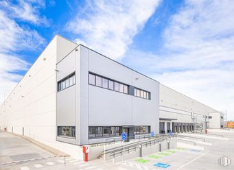
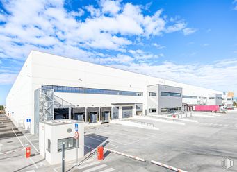
- Newly built logistics platform
- Unbeatable location
- Excellent communications
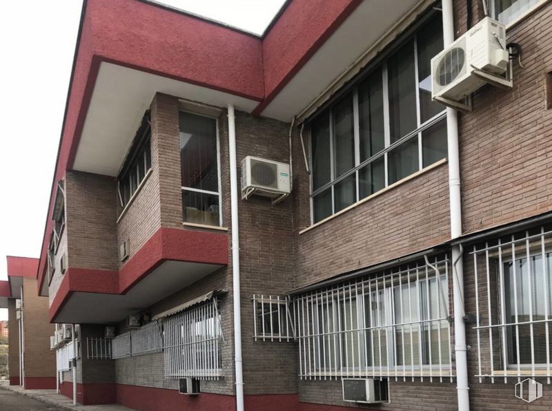
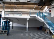
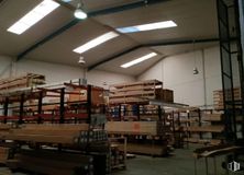
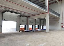
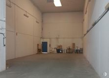
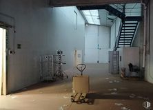
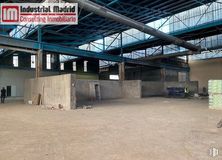
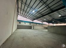
Available both for sale and for rent industrial warehouse of 12,088 m2 of surface, which include about 1,200 m2 of office use and 10,888 m2 of industrial use. The building consists of three warehouses and a building annexed to them where the offices, dining area, changing rooms, toilets and an area for industrial use are located.
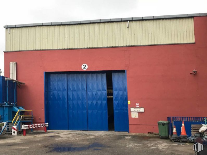
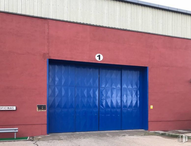
The warehouses occupy a space of 20 meters wide by 160 meters long, and are currently all joined without separation walls, with two large access gates to them. The plot covers 12,610 m2, with a buildable coefficient of 2.4 m2/m2.
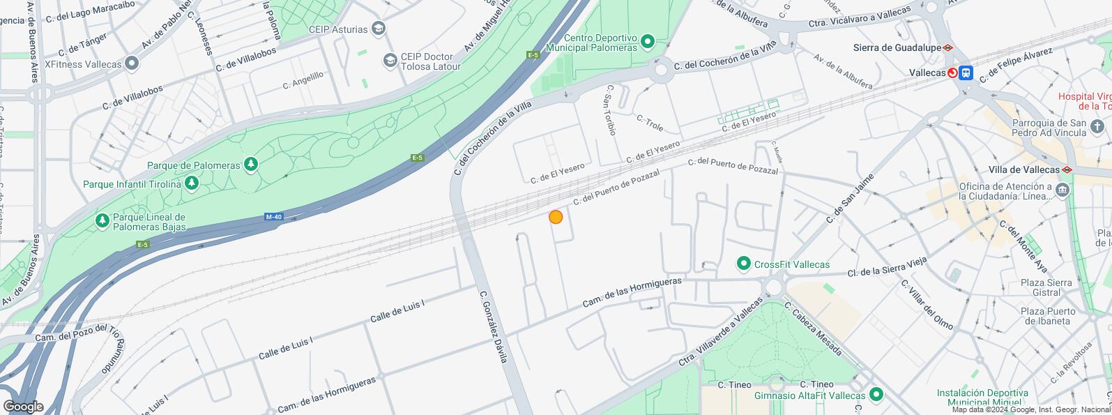
It is located on Calle de González Davila, the main street of the Vallecas Polígono, so it has good visibility and easy access to the M-40, A-3 and M-30.
| Floor | Use | m2 | €/mo | €/m2/mo | Space layout | Availability |
|---|---|---|---|---|---|---|
| Property | Industrial | 12,088 | 55,000 | 4.55 | Partitioned | Available now |
| Bus | Line | Distance |
|---|---|---|
| Cº Hormigueras-Gonzalez Davila | 130, T31 | 155 m |
| Cno. Hormigueras, 168 | 130, T31 | 291 m |
| Cno.Hormigueras, 165 | 130, T31 | 297 m |
| Cº Hormigueras-Casas de Miravete | 130, T31 | 359 m |
| Commuter train | Line | Distance |
|---|---|---|
| Vallecas | C1, C2, C7 | 1 km |
| El Pozo | C1, C2, C7 | 1 km |
| Asamblea de Madrid-Entrevías | C1, C2, C7 | 2 km |
| Santa Eugenia | C1, C2, C7 | 3 km |
| Transport Node | Distance |
|---|---|
| Estación de Autobuses de Méndez Álvaro | 4 km |
| Estación de Atocha Renfe | 5 km |
| Aeropuerto Adolfo Suárez-Madrid Barajas | 11 km |
| Estación de Madrid-Chamartín | 11 km |
| Commercial areas | Distance |
|---|---|
| Mercado Municipal de Villa de Vallecas | 1 km |
| Carrefour Madrid Sur | 2 km |
| C.C. Madrid Sur | 2 km |
| Alcampo Vallecas | 2 km |
| Hotels | Distance |
|---|---|
| Hotel Etap Vallecas * | 569 m |
| Hotel Diana Plus **** | 2 km |
| Hotel Mercader **** | 3 km |
| Public Administration | Distance |
|---|---|
| Junta Municipal de Distrito. Villa de Vallecas | 1 km |
| Administración de la Agencia Tributaria Villa Vallecas | 3 km |
| Ayuntamiento de Madrid | 6 km |
| Health | Distance |
|---|---|
| Centro de Salud Campo de la Paloma | 936 m |
| C.E. Federica Montseny | 1 km |
| Protection and security | Distance |
|---|---|
| Policía Municipal (OAC) Puente de Vallecas | 2 km |
| Comisaría - Madrid - Moratalaz | 2 km |
| Parque de Bomberos de Madrid Nº 8. Puente de Vallecas | 2 km |
| I.Armas y Explosivos - Madrid | 3 km |
| Base de socorro de la Cruz Roja de Madrid. Avda. Moratalaz 50-52 | 4 km |
| Other points of interest | Distance |
|---|---|
| Gasolinera Carretera M-602 Villaverde-Vallecas, 283 | 372 m |
| Farmacia Calle de la Fuente de Piedra 2, Madrid | 567 m |
| Farmacia Calle de Santa Cruz de Retamar 13, Madrid | 794 m |
| Parking público. Metro de Madrid Miguel Hernández | 1 km |


Villa de Vallecas