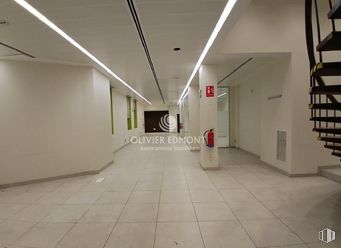
Ideal as a warehouse because it is completely open plan
Consolidated zone
Good communication with transport
Verified Listing
The content of this page has been verified by the Belbex Research team – CoStar Group
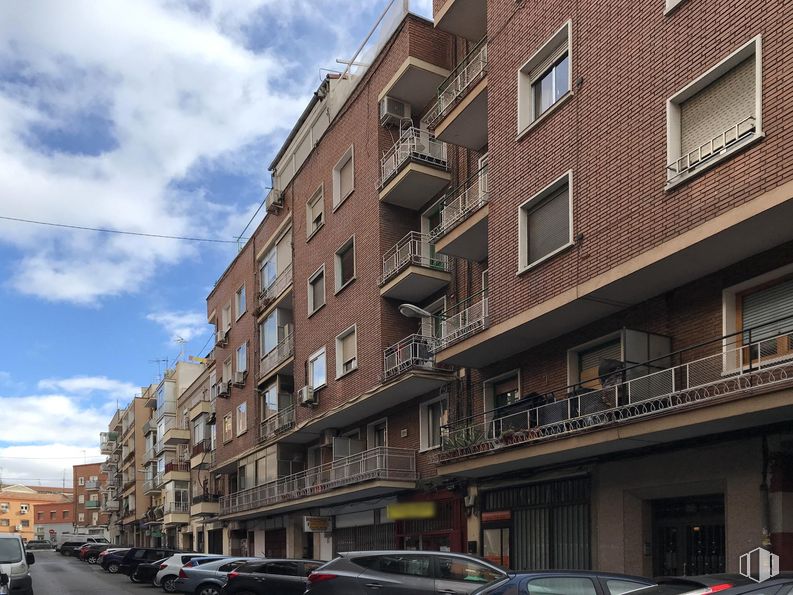
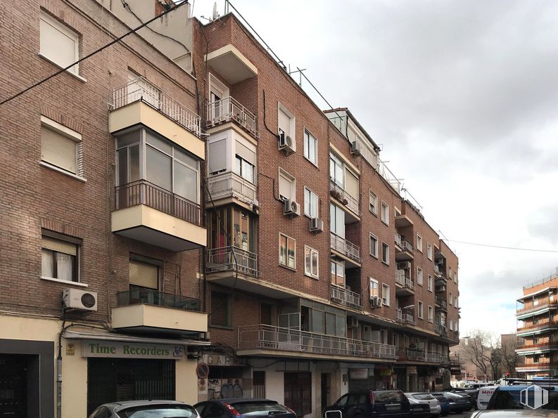
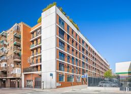
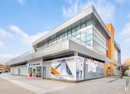
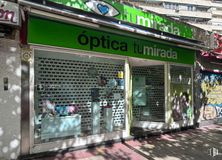
Premises are rented in the Usera area, in Madrid.
These are ideal spaces to be used as a warehouse since they are in an area with little public traffic. The spaces are completely open. It is a consolidated environment that has good communication with transport.
Spaces
Floor
Use
m2
€/mo
€/m2/mo
Space layout
Availability
Ground
Retail
30
350
11.67
Open Plan
Available now
Ground
Retail
30
350
11.67
Open Plan
Available now
Last updated 3 months ago
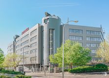
Building info
Total Floor: 6Construction year: 1965
Amenities
On the street
Bus stop
Public Transportation
Natural Light - Good
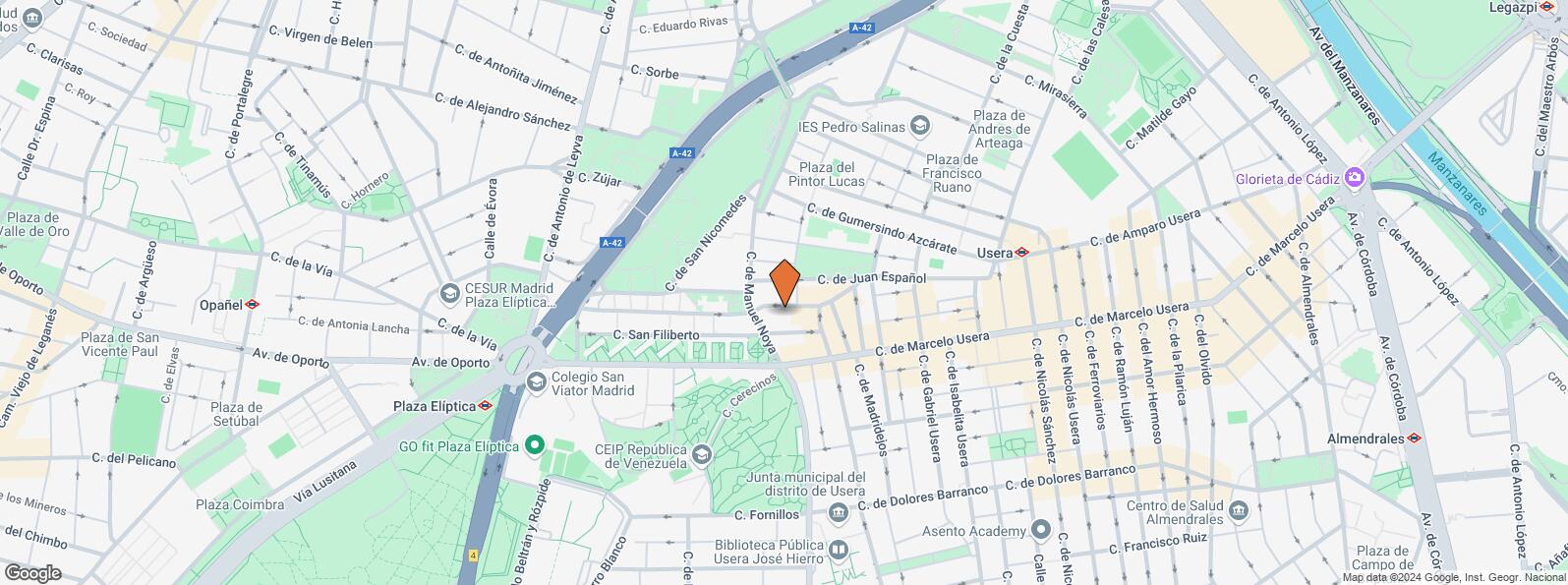
Location map
Map loading...
Contact
Transport
Bus
Line
Distance
Marcelo Usera-Rafaela Ybarra
47, 60, 81, 247
99 m
Marcelo Usera-Av.Rafaela Ybarra
47, 60, 81, 247
116 m
Rafaela Ybarra-Marcelo Usera
N15
125 m
Marcelo Usera-Gabriel Usera
47, 247, N15
289 m
Underground
Line
Distance
Plaza Elíptica
6, 11
484 m
Usera
6
568 m
Interurban bus
Line
Distance
Madrid - Pº Sta. Mª Cabeza - Pza. Fdez. Ladreda
N801, N805, N806
433 m
Madrid - Pº Sta. Mª Cabeza - Baleares
N801, N801, N805, N805, N806, N806
440 m
Madrid - Pº Sta. Mª Cabeza - Est. Plaza Elíptica
N801, N805, N806
449 m
Commuter train
Line
Distance
Doce de Octubre
C5
1 km
Pirámides
C1, C7, C10
2 km
Orcasitas
C5
2 km
Delicias
C1, C7, C10
2 km
Transport Node
Distance
Intercambiador de Plaza Elíptica
581 m
Estación de Atocha Renfe
3 km
Estación de Madrid-Chamartín
10 km
Aeropuerto Adolfo Suárez-Madrid Barajas
14 km
Points of interest
Commercial areas
Distance
Mercado Municipal de Usera
493 m
Mercado Municipal de Jesús del Gran Poder
908 m
C.C. Plaza Río 2
989 m
Alcampo Madrid Río
1 km
Hotels
Distance
Hotel Praga ****
971 m
Hotel NH Ribera del Manzanares ****
2 km
Public Administration
Distance
Junta Municipal de Distrito. Usera
406 m
Oficinas de empleo de Usera
810 m
Administración de la Agencia Tributaria Villaverde-Usera
988 m
Oficinas de empleo de San Isidro
1 km
Ayuntamiento de Madrid
4 km
Health
Distance
Centro de Salud Joaquín Rodrigo
537 m
C.E. Orcasitas
1 km
Protection and security
Distance
Comisaría tramitación de DNI y pasaporte - Madrid - Usera - Villaverde 2
649 m
Parque de Bomberos de Madrid Nº 5. Usera
786 m
Policía Municipal (OAC) Arganzuela
1 km
SEPRONA/I.C.A.E./Zona de Madrid
2 km
Centro de Inserción Social Victoria Kent
2 km
Other points of interest
Distance
Farmacia Calle de Enrique Fuentes 14, Madrid
32 m
Farmacia Calle del Doctor Carmena Ruiz 37, Madrid
202 m
Parking mixto. Calle Ortiz Campos
390 m
Gasolinera Paseo Santa Maria de la Cabeza, 168 (Plaza Elíptica)
Usera District is one of Madrid’s 21 districts, administratively arranged in the following quarters: Orcasitas, Orcasur, San Fermín, Almendrales, Moscardó, Zofío and Pradolongo. It covers a surface of 770.28 hectares and it is delimited by the River Manzanares, Puente de Praga, Paseo de Santa María de la Cabeza, Plaza de Fernández Ladreda, roads A-42 and M-40. It borders to the west and nothwest with Carabanchel, to the northeast with Arganzuela, to the east with Puente de Vallecas, and to the south with Villaverde District.