Industrial for rent 9 m2 | Floor 1
150 €/mo | 16.67 €/m2/mo
- Industrial area
- Ideal as a small working place
- Enclosure with 24-hour surveillance
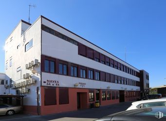
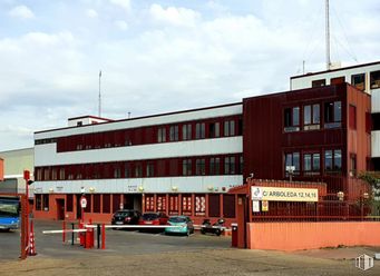
Industrial building in chamfer in the neighborhood of Palomeras Sureste, in the district of Villa de Vallecas, within a very consolidated industrial environment and with good communications, both by public transport (near the Cercanías de Vallecas Station and the Sierra de Guadalupe Metro Station) and by private transport, with quick and convenient access to the A-3 and M-40.
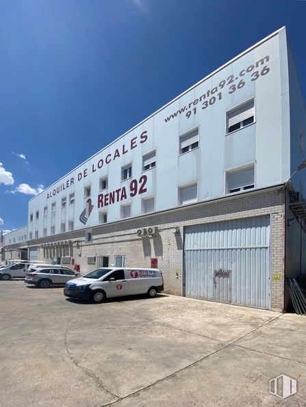
Warehouses located on the ground floor, with different surfaces, check availability. Use as a workspace, warehouse, storage room... includes 3 megs of free internet included in the price. 24-hour access, CCTV surveillance and 24-hour doormen.
Spaces
| Floor | Use | m2 | €/mo | €/m2/mo | Space layout | Availability |
|---|---|---|---|---|---|---|
| 1 | Industrial | 9 | 150 | 16.67 | Open Plan | Available now |
Building info
Total Floor: 2Construction year: 1990
Amenities
- Toilets
- Natural lighting
- Gate
- Yard
- Fire detection system
- Warehouse
- Parking
- Enclosure closed
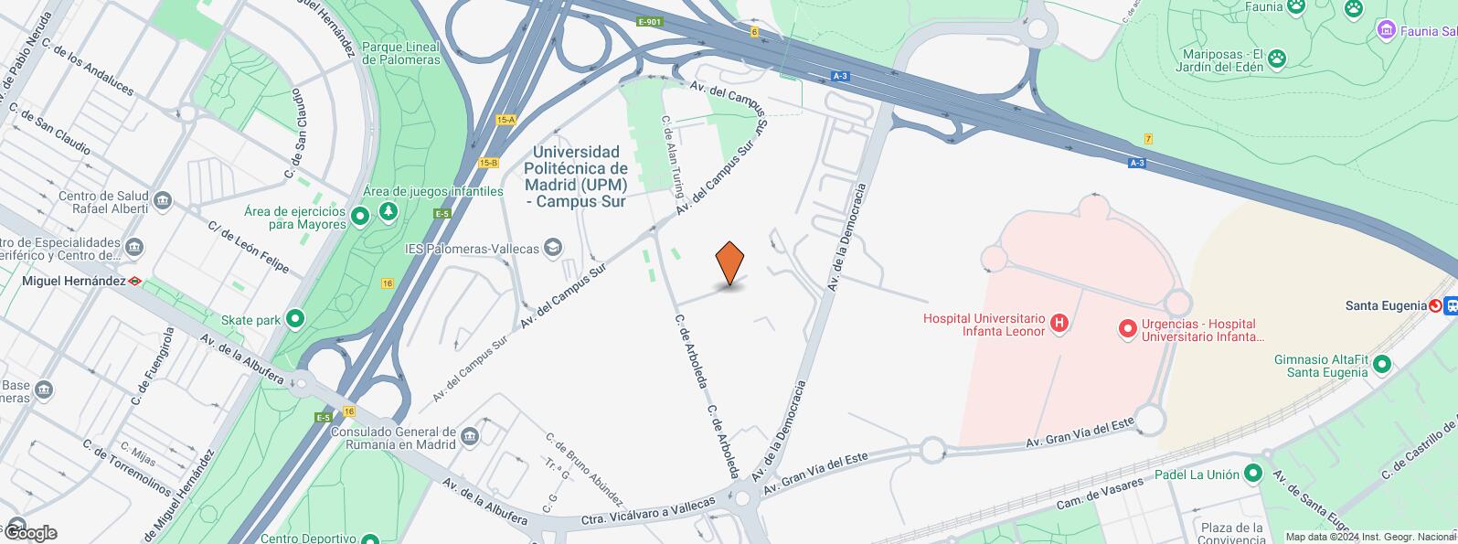
Location map
Map loading...Contact
Transport
| Bus | Line | Distance |
|---|---|---|
| Escuela Ingenieria Tecnica-Arboleda | E | 158 m |
| Escuela de Maestria Industrial | E | 290 m |
| Av.Democracia-Av.Mediterraneo | 130 | 326 m |
| Arboleda-Avenida Democracia | E | 348 m |
| Underground | Line | Distance |
|---|---|---|
| Sierra de Guadalupe | 1 | 532 m |
| Villa de Vallecas | 1 | 981 m |
| Interurban bus | Line | Distance |
|---|---|---|
| Rivas - Vaciamadrid - Av. Mediterraneo - Av. Democrac | 331, 332, 333, 334, N301, N302 | 430 m |
| Commuter train | Line | Distance |
|---|---|---|
| Vallecas | C1, C2, C7 | 623 m |
| Santa Eugenia | C1, C2, C7 | 1 km |
| El Pozo | C1, C2, C7 | 3 km |
| Vicálvaro | C1, C2, C7 | 3 km |
| Transport Node | Distance |
|---|---|
| Área Intermodal de Alsacia | 3 km |
| Estación de Atocha Renfe | 6 km |
| Aeropuerto Adolfo Suárez-Madrid Barajas | 9 km |
| Estación de Madrid-Chamartín | 11 km |
Points of interest
| Commercial areas | Distance |
|---|---|
| Mercado Municipal de Villa de Vallecas | 974 m |
| C.C. Valdebernardo | 1 km |
| Mercado Municipal de Santa Eugenia | 2 km |
| Alcampo Vallecas | 3 km |
| Public Administration | Distance |
|---|---|
| Junta Municipal de Distrito. Villa de Vallecas | 1 km |
| Oficinas de empleo de Santa Eugenia | 1 km |
| Oficinas de empleo de Moratalaz | 1 km |
| Administración de la Agencia Tributaria Villa Vallecas | 2 km |
| Ayuntamiento de Madrid | 7 km |
| Health | Distance |
|---|---|
| Hospital Universitario Infanta Leonor | 724 m |
| Hospital Virgen de La Torre | 928 m |
| Protection and security | Distance |
|---|---|
| Policía Municipal (OAC) Villa de Vallecas | 1 km |
| Comisaría - Madrid - Moratalaz | 2 km |
| Parque de Bomberos de Madrid Nº 8. Puente de Vallecas | 2 km |
| Base de socorro de la Cruz Roja de Madrid. Avda. Moratalaz 50-52 | 3 km |
| Other points of interest | Distance |
|---|---|
| Gasolinera Carretera N-III Madrid-Valencia, km. 7'100 (margen derecho) | 407 m |
| Farmacia Avenida de la Albufera 432 L 9-C, Madrid | 665 m |
| Farmacia Calle de Jesús del Pino 24, Madrid | 685 m |
| Parking público. Metro de Madrid Miguel Hernández | 1 km |
| Parque Forestal de Valdebernardo (Vicálvaro) | 2 km |
| Parque Dionisio Ridruejo | 2 km |
Other properties in the Renta 92 portfolio
- Calle Arboleda, 14-16Puente de Vallecas, Madrid 28031Office for rent15 m2 | Floor 115 €/m2/mo | 225 €/mo

- Calle Arboleda, 14Puente de Vallecas, Madrid 28031Retail for rent40 m2 | Floor Ground13.75 €/m2/mo | 550 €/mo

Puente de Vallecas
Puente de Vallecas
Puente de Vallecas district covers an area of 1,489.14 hectares and is located to the southeast of Madrid. It is one of the most populated areas of the capital. It borders to the east with Villa de Vallecas, separated from it by Avenida de la Democracia, the Madrid - Zaragoza railway line and the M-40; to the north with Moratalaz, separated by the A3; to the west with Retiro and Arganzuela, separated by the M30 and to the southeast with Usera, separated by the River Manzanares. Cerro del Tío Pío Park is located in Puente de Vallecas District, and is one of Madrid’s viewpoints and one of the most popular green areas in the southern part of the city.
Local call rate
Popular searches
- Shops in Madrid
- Shops for rent in Madrid
- Warehouse for rent in Madrid
- Offices for rent in Madrid
- Shops for sale in Madrid
- Shops in Madrid city center
- Shops for rent in Alcalá de Henares
- Shops for rent in Leganes
- Shops for rent in Mostoles
- Offices for sale in Madrid
- Warehouse for sale in Madrid
- Warehouses in Madrid
Other relevant searches
- Villaverde industrial spaces for rent
- Villa de Vallecas industrial spaces for rent
- Vicálvaro industrial spaces for rent
- Casco Historico de Vallecas industrial spaces for rent
- Casco Historico de Vallecas industrial spaces for sale
- Camino Hormigueras industrial spaces for rent
- Calle Luis I industrial spaces for rent
- Calle Puerto De Used industrial spaces for rent


