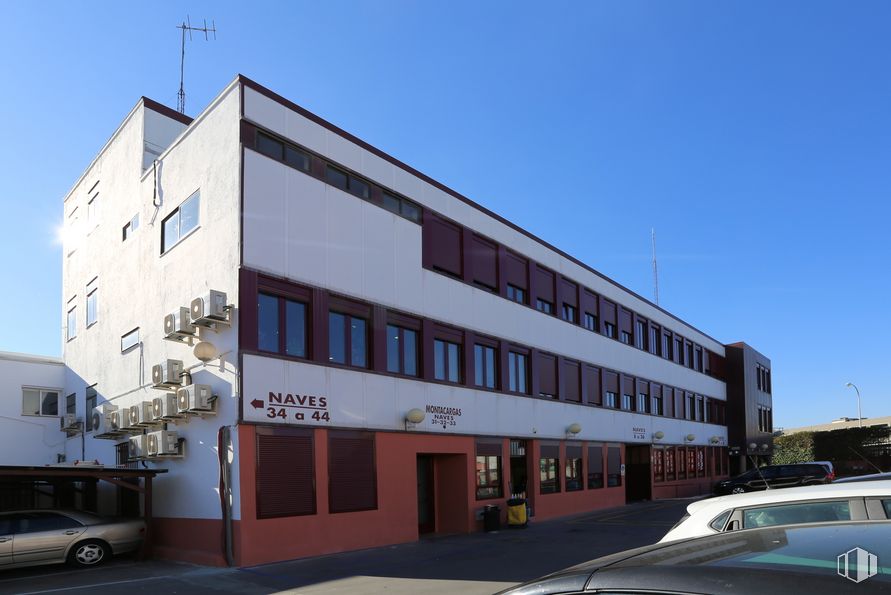
Office for rent | 1 Workstation 15 m2 | Floor 1
225 €/mo | 15 €/m2/mo
- Office in the Arboleda Business Center
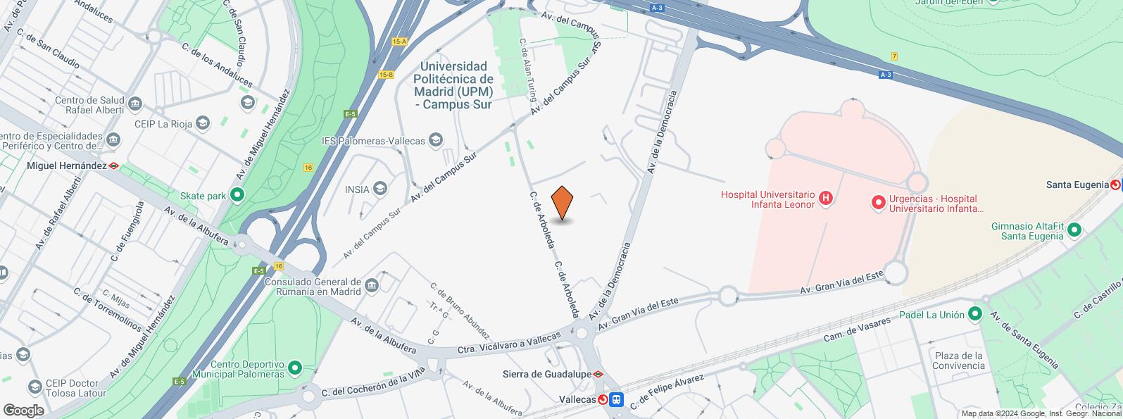
- Good access to the A-3, M-40 and M-45
- Good communications by metro, commuter and bus
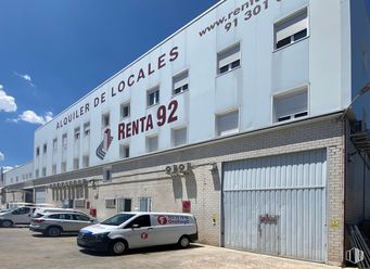
45 m2 office for rent in the Arboleda business center, 5 minutes from Conde de Casal via A-3 with direct access to M-40, 3 minutes from the M-45. It is located next to the Sierra de Guadalupe subway, the Vallecas commuter station and the buses: e, 54, 58, 103, 130, 142, 143, h1 and t31.
It is a fully equipped office, furnished for two workplaces and ready to develop your business activity.
It is equipped with pre-installation of fiber optics and telephone, several common toilets on each floor of the building, access and physical surveillance and 24-hour ccTV, permanent attention by the concierge staff, secure parking, reprography, fax and meeting rooms available to customers.
Spaces
| Floor | Use | m2 | €/mo | €/m2/mo | Space layout | Availability |
|---|---|---|---|---|---|---|
| 1 | Office | 15 | 225 | 15 | Open Plan | Available now |
Building info
Total Floor: 4Construction year: 1970
Amenities
- Height
- Toilets
- Natural lighting
- Gate
- Parking area
- Hot water
- Alarm
- Ceiling height: 2,5 m
- Open-Plan
- Optical fiber cable
- Enclosure closed
Location map
Map loading...Contact
Transport
| Bus | Line | Distance |
|---|---|---|
| Arboleda-Avenida Democracia | E | 190 m |
| Av.Democracia-Arboleda | 130 | 216 m |
| Av.Democracia-Gran Via del Este | 130 | 261 m |
| Escuela Ingenieria Tecnica-Arboleda | E | 274 m |
| Underground | Line | Distance |
|---|---|---|
| Sierra de Guadalupe | 1 | 375 m |
| Villa de Vallecas | 1 | 837 m |
| Commuter train | Line | Distance |
|---|---|---|
| Vallecas | C1, C2, C7 | 470 m |
| Santa Eugenia | C1, C2, C7 | 1 km |
| El Pozo | C1, C2, C7 | 3 km |
| Transport Node | Distance |
|---|---|
| Área Intermodal de Alsacia | 4 km |
| Estación de Atocha Renfe | 6 km |
| Aeropuerto Adolfo Suárez-Madrid Barajas | 9 km |
| Estación de Madrid-Chamartín | 11 km |
Points of interest
| Commercial areas | Distance |
|---|---|
| Mercado Municipal de Villa de Vallecas | 820 m |
| C.C. Valdebernardo | 1 km |
| Mercado Municipal de Santa Eugenia | 2 km |
| Alcampo Vallecas | 3 km |
| Public Administration | Distance |
|---|---|
| Junta Municipal de Distrito. Villa de Vallecas | 878 m |
| Oficinas de empleo de Santa Eugenia | 1 km |
| Administración de la Agencia Tributaria Villa Vallecas | 2 km |
| Oficinas de empleo de Moratalaz | 2 km |
| Ayuntamiento de Madrid | 7 km |
| Health | Distance |
|---|---|
| Hospital Universitario Infanta Leonor | 709 m |
| Hospital Virgen de La Torre | 810 m |
| Protection and security | Distance |
|---|---|
| Policía Municipal (OAC) Villa de Vallecas | 1 km |
| Comisaría - Madrid - Moratalaz | 2 km |
| Parque de Bomberos de Madrid Nº 8. Puente de Vallecas | 2 km |
| Base de socorro de la Cruz Roja de Madrid. Avda. Moratalaz 50-52 | 3 km |
| Other points of interest | Distance |
|---|---|
| Farmacia Calle de Jesús del Pino 24, Madrid | 535 m |
| Farmacia Avenida de la Albufera 432 L 9-C, Madrid | 539 m |
| Gasolinera Carretera N-III Madrid-Valencia, km. 7'100 (margen derecho) | 562 m |
| Parking público. Metro de Madrid Miguel Hernández | 1 km |
| Parque Forestal de Valdebernardo (Vicálvaro) | 2 km |
Other properties in the Renta 92 portfolio
- Calle San Jaime, 1Villa de Vallecas, Madrid 28031Office for rent18 m2 | Floor 116.67 €/m2/mo | 300 €/mo
- Calle Arboleda, 14Puente de Vallecas, Madrid 28031Retail for rent40 m2 | Floor Ground13.75 €/m2/mo | 550 €/mo
- Calle Arboleda, 18Puente de Vallecas, Madrid 28031Industrial for rent9 m2 | Floor 116.67 €/m2/mo | 150 €/mo
Puente de Vallecas
Puente de Vallecas
Puente de Vallecas district covers an area of 1,489.14 hectares and is located to the southeast of Madrid. It is one of the most populated areas of the capital. It borders to the east with Villa de Vallecas, separated from it by Avenida de la Democracia, the Madrid - Zaragoza railway line and the M-40; to the north with Moratalaz, separated by the A3; to the west with Retiro and Arganzuela, separated by the M30 and to the southeast with Usera, separated by the River Manzanares. Cerro del Tío Pío Park is located in Puente de Vallecas District, and is one of Madrid’s viewpoints and one of the most popular green areas in the southern part of the city.
Local call rate
Popular searches
- Shops in Madrid
- Shops for rent in Madrid
- Warehouse for rent in Madrid
- Offices for rent in Madrid
- Shops for sale in Madrid
- Shops in Madrid city center
- Shops for rent in Alcalá de Henares
- Shops for rent in Leganes
- Shops for rent in Mostoles
- Offices for sale in Madrid
- Warehouse for sale in Madrid
- Warehouses in Madrid
Other relevant searches
- Arganzuela office spaces for rent
- Retiro office spaces for rent
- Villa de Vallecas office spaces for rent
- Casco Historico de Vallecas office spaces for rent
- Casco Historico de Vallecas office spaces for sale
- Avenida Albufera office spaces for rent
- Calle Casas De Miravete office spaces for rent
- Camino Hormigueras office spaces for rent
