
199 m2
| Floor Ground
300,000 €
| 1,508 €/m2
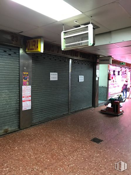
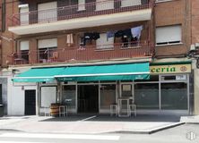
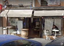
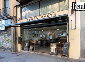
Commercial stand in the food market.
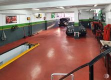
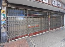
This station is diaphanous and has a counter, ceramic floor, tiled walls, lighting using fluorescent bars and large and fully functional metal safety locks.
He has been in the poultry business for many years.
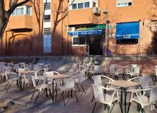
It is located in a neighborhood market mainly aimed at selling fresh food. It is a commercial area that has been established for several decades, known and frequented by residents of an area with a high population density. In this market, there are business opportunities such as fruit and vegetable stores.
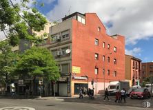
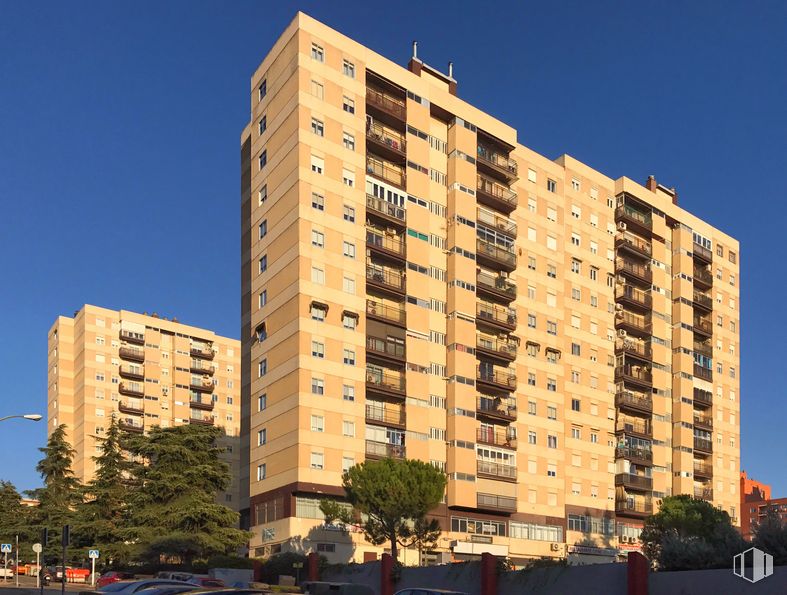
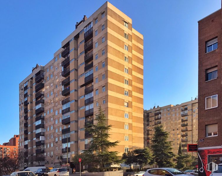
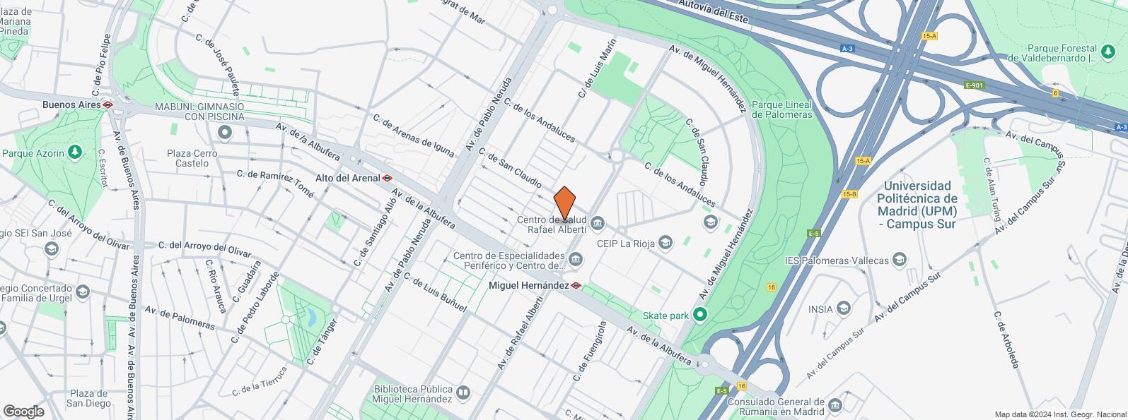
It is very well connected, as it is located at the foot of Avenida Rafael Alberti, at the confluence with Avenida de la Albufera. This gives you direct access to the M40 and A3.
In addition, in front of the building there is an urban bus stop (lines 54 and 144) and 150 meters away is the Miguel Hernández metro stop (line 1).
The price is negotiable.
| Floor | Use | m2 | € | €/m2 | Space layout | Availability |
|---|---|---|---|---|---|---|
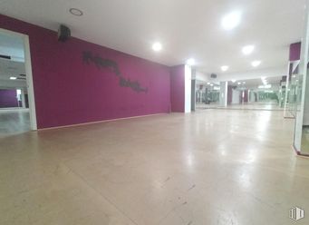
| Ground | Retail | 14 | 6,000 | 429 | Open Plan | Available now |
Service Charge 200 €/mo (14.29 €/m2/mo)
| Bus | Line | Distance |
|---|---|---|
| Rafael Alberti-San Claudio | 54, 144, N10 | 129 m |
| Av.Albufera-Av.Rafael Alberti | 54, 58, 103, 142, 143, N25 | 174 m |
| Rafael Alberti-Av.Albufera | 144, N10 | 189 m |
| Andaluces-Av.Rafael Alberti | 54, 144, N10 | 213 m |
| Underground | Line | Distance |
|---|---|---|
| Miguel Hernández | 1 | 210 m |
| Alto del Arenal | 1 | 451 m |
| Commuter train | Line | Distance |
|---|---|---|
| Vallecas | C1, C2, C7 | 2 km |
| El Pozo | C1, C2, C7 | 2 km |
| Asamblea de Madrid-Entrevías | C1, C2, C7 | 2 km |
| Santa Eugenia | C1, C2, C7 | 3 km |
| Transport Node | Distance |
|---|---|
| Área Intermodal de Conde de Casal | 3 km |
| Estación de Atocha Renfe | 5 km |
| Aeropuerto Adolfo Suárez-Madrid Barajas | 10 km |
| Estación de Madrid-Chamartín | 10 km |
| Taxi | Stop | Distance |
|---|---|---|
| Avenida de Rafael Alberti, S/N | 13.10 | 91 m |
| Commercial areas | Distance |
|---|---|
| Alcampo Vallecas | 1 km |
| C.C. Albufera | 1 km |
| Mercado Municipal de Numancia | 2 km |
| Mercado Municipal de Villa de Vallecas | 2 km |
| Hotels | Distance |
|---|---|
| Hotel Diana Plus **** | 3 km |
| Public Administration | Distance |
|---|---|
| Junta Municipal de Distrito. Moratalaz | 1 km |
| Oficinas de empleo de Moratalaz | 1 km |
| INSS - Centros Urbanos - Nº 3 | 1 km |
| Administración de la Agencia Tributaria Vinateros | 3 km |
| Ayuntamiento de Madrid | 6 km |
| Health | Distance |
|---|---|
| Centro de Salud Rafael Alberti | 82 m |
| C.E. Federica Montseny | 136 m |
| Protection and security | Distance |
|---|---|
| Comisaría - Madrid - Moratalaz | 855 m |
| Policía Municipal (OAC) Moratalaz | 1 km |
| Parque de Bomberos de Madrid Nº 8. Puente de Vallecas | 1 km |
| I.Armas y Explosivos - Madrid | 2 km |
| Base de socorro de la Cruz Roja de Madrid. Avda. Moratalaz 50-52 | 2 km |
| Other points of interest | Distance |
|---|---|
| Farmacia Calle de San Claudio 48, Madrid | 116 m |
| Farmacia Calle de San Claudio 99, Madrid | 158 m |
| Parking público. Metro de Madrid Miguel Hernández | 221 m |
| Gasolinera Avenida Albufera, 319 | 789 m |
| Parque Cerro del Tío Pío | 2 km |
| Parque Palomeras Bajas | 2 km |

Puente de Vallecas