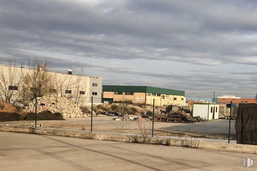
Land for sale 3,821 m2 buildable | 5,664 m2 plot
Price upon request
- Easy access by the Valencia Road
- Ideal environment for the development of any industrial activity
- Investment planned by the Community of Madrid to create a logistics pole
Ref.: 8117
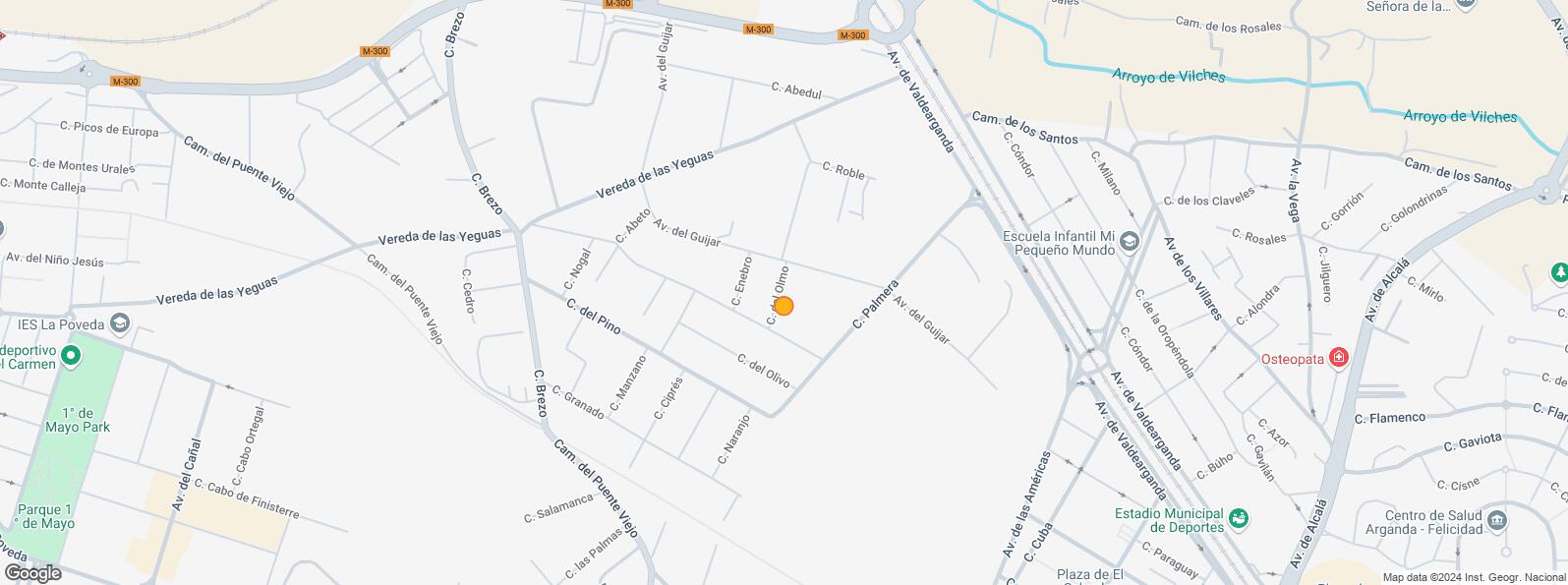
Industrial plot perfectly located in Aranda del Rey, next to Avenida de Valdearanda and close to the R-3.
The plot, with an area of 5,664 m2, consists of two contiguous plots of 2,859 m2 and 2,805 m2 that confirm an almost rectangular plot. The land has a buildable area of 3,821 m2, with an occupancy of 2,831 on the ground floor and a maximum of two floors. Easement of passage in the rear area of 150 m2.
The space can include a maximum of 12 warehouses and is located in an ideal environment, El Guijar Industrial Estate, to carry out any industrial activity.
The area has easy parking and easy access via the Carretera de Valencia. An investment is planned by the Community of Madrid to expand the A-3 and create a logistics hub in the Argada area.
Location map
Map loading...Transport
| Bus | Line | Distance |
|---|---|---|
| Av.Valdearganda-Vencejo | 1 | 366 m |
| Av.Valdearganda-Vda.Yeguas | 1 | 441 m |
| Underground | Line | Distance |
|---|---|---|
| Arganda del Rey | 9 | 2 km |
| La Poveda | 9 | 2 km |
| Interurban bus | Line | Distance |
|---|---|---|
| Madrid - Av. Alcalá de Henares - Urb. los Villares | 313 | 959 m |
| Valdilecha - Av. Alcalá de Henares - Urb. los Villa | 313 | 991 m |
| Madrid - Av. Madrid - Psje. Ana Mª del Valle | 312, 326, 351, 352, 353, 312A, N303 | 999 m |
| Transport Node | Distance |
|---|---|
| Aeropuerto Adolfo Suárez-Madrid Barajas | 19 km |
| Estación de Atocha Renfe | 22 km |
| Estación de Madrid-Chamartín | 26 km |
Points of interest
| Commercial areas | Distance |
|---|---|
| C.C. Zoco Arganda | 2 km |
| Mercado Municipal Arganda Del Rey | 2 km |
| Parque Comercial Rivas Futura | 6 km |
| Hotels | Distance |
|---|---|
| Hotel Sercotel AB Arganda **** | 1 km |
| Hotel Guillén * | 2 km |
| Hotel Mirador del Río ** | 4 km |
| Public Administration | Distance |
|---|---|
| Oficinas de empleo de Arganda | 1 km |
| Administración de la Agencia Tributaria Arganda del Rey | 2 km |
| Ayuntamiento de Arganda del Rey | 2 km |
| Servicio Común Actos Comunicación y Ejecución - Oficina Decanato | 3 km |
| Primera Instancia e Instrucción - Violencia sobre la Mujer | 3 km |
| Health | Distance |
|---|---|
| Consultorio de La Poveda | 2 km |
| Hospital Universittario del Sureste | 2 km |
| Protection and security | Distance |
|---|---|
| Base de socorro de la Cruz Roja de Arganda. Calle Real 79 | 3 km |
| Parque de Bomberos de Arganda del Rey | 3 km |
| Guardia civil Puesto/Equipo P.J./I. Armas y Explosivos Arganda del Rey | 3 km |
| Other points of interest | Distance |
|---|---|
| Gasolinera Avenida Valdearganda, 8 | 954 m |
| Parking público. Estación La Poveda | 2 km |
| Parking público. Estación de Metro | 2 km |
Other properties in the Masachs portfolio
- Calle AbejarucoPinto, Madrid 28320Land for sale2,556 m2 buildable | 4,000 m2 plotPrice upon request

- Polígono Industrial UrtinsaAlcorcón, Madrid 28923Land for sale1,100 m2 buildable | 805 m2 plot433 €/m2 | 476,000 €

- Calle Berzosa de Lozoya, 6Villaverde, Madrid 28021Land for sale3,303 m2 buildable | 3,797 m2 plot310 €/m2 | 1,177,070 €

Arganda del Rey
Arganda del Rey
Popular searches
- Shops in Madrid
- Shops for rent in Madrid
- Warehouse for rent in Madrid
- Offices for rent in Madrid
- Shops for sale in Madrid
- Shops in Madrid city center
- Shops for rent in Alcalá de Henares
- Shops for rent in Leganes
- Shops for rent in Mostoles
- Offices for sale in Madrid
- Warehouse for sale in Madrid
- Warehouses in Madrid
Other relevant searches
- Loeches land spaces for sale
- Campo Real land spaces for sale
- Perales de Tajuña land spaces for sale
- Velilla de San Antonio land spaces for sale
- Calle Sierra De Algodonales land spaces for sale
- Camino Valdepencas land spaces for sale
- Camino Puente Viejo land spaces for sale
- Calle Cabo Trafalgar land spaces for sale


