The content of this page has been verified by the Belbex Research team – CoStar Group
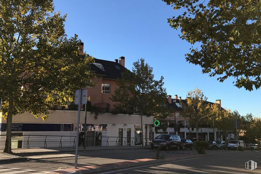
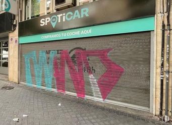
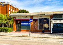
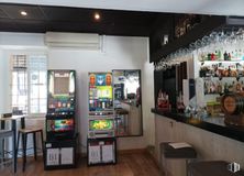
Local with terrace of minimum 100 meters. Renovated and in perfect condition with air conditioning and bathroom. Almost 6 meters. Facade. Facilities according to current regulations. Smoke output. Last activity: dry cleaning. Automatic closing. Alarm. Located on a pedestrian platform in an area of high housing concentration. BETTER WATCH IT ——
Last updated 3 months ago
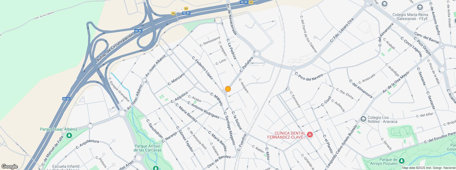
Location map
Map loading...
Rent history
Floor
Use
m2
Date
Ground
Retail
52
Feb. 2013
Ground
Retail
52
Feb. 2013
Note: This table contains the listings added and the listings that were modified according to their type, use, m2 or price
Transport
Underground
Line
Distance
Berna
ML-2
2 km
Estación de Aravaca
ML-2
2 km
Interurban bus
Line
Distance
Pozuelo de Alarcon - Peñalara - Av. Navacerrada
563, 656A
298 m
Madrid - Peñalara - Av. Navacerrada
563, 656A
304 m
Madrid - Guadarrama - Pedriza
656A
417 m
Commuter train
Line
Distance
El Barrial-Centro Comercial Pozuelo
C7, C10
1 km
Pozuelo
C7, C10
1 km
Aravaca
C7, C10
2 km
Majadahonda
C7, C10
4 km
Transport Node
Distance
Estación de Madrid-Chamartín
10 km
Estación de Atocha Renfe
11 km
Aeropuerto Adolfo Suárez-Madrid Barajas
20 km
Points of interest
Commercial areas
Distance
C.C. Pozuelo - Tiendas El Corte Inglés
751 m
Hipercor Pozuelo
802 m
C.C. La Estación
1 km
E-Lecrerc Majadahonda
4 km
Hotels
Distance
Hotel Aravaca Village ****
2 km
Hotel AC Aravaca ****
2 km
Hotel Meliá Madrid Princesa *****
8 km
Public Administration
Distance
Consulado de la República Centroafricana
589 m
Administración de la Agencia Tributaria Pozuelo Alarcón
2 km
Ayuntamiento de Pozuelo de Alarcón
3 km
Embajada de la República Popular Democrática de Corea
3 km
Consulado de Uzbekistán
3 km
Health
Distance
Hospital La Zarzuela
2 km
Hospital Pardo de Aravaca
2 km
Protection and security
Distance
Base de socorro de la Cruz Roja de Pozuelo de Alarcón. Avda. Juan XXIII 6-8
1 km
Comisaría tramitación de DNI y pasaporte, Oficina de extranjeros - Pozuelo de Alarcón
2 km
Other points of interest
Distance
Farmacia Calle de Peñalara 2, Pozuelo de Alarcón
6 m
Gasolinera Travesia de Peñalara, 1
218 m
Farmacia Calle Gómez Tejedor 50, Pozuelo de Alarcón
445 m
Parque de las Minas
1 km
Parking mixto. Calle Corona Boreal
2 km
Parking público. Estación de Cercanias de Majadahonda
Pozuelo de Alarcón is a Spanish town located in the Region of Madrid 8 km to the west of the capital. It covers an area of 43.2 km2 and is the only town, apart from the capital itself, that lies inside the M-40 ring road. It borders to the north and east with Moncloa - Aravaca District, to the south with La Latina District and to the west with the towns of Alcorcón, Majadahonda and Boadilla del Monte. Over recent decades it has gradually replaced its agricultural past for its residential and commercial present.