Land for sale 28,560 m2 buildable | 11,424 m2 plot
Price upon request
- Plots for tertiary use (industrial and commercial) in Vicalvaro
- Maximum height of 20 meters and 4 heights
- Easy access via the R-3 and M-45
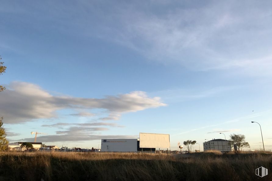
Plot for industrial use of 11,424 m2 of total area located in the district of Vicalvaro.
The plot (ref.: M.20.3) has a building area above ground of 28,560 m2 (coefficient of 2.5 m2/m2). Maximum allowed height of 20 meters and a maximum of 4 heights (lower+3+attic).
Ideal land for buildings intended for business services and tertiary activities (commercial and industrial). The applicable ordinance for the zone is Zone 9 Level A. API 19.04.
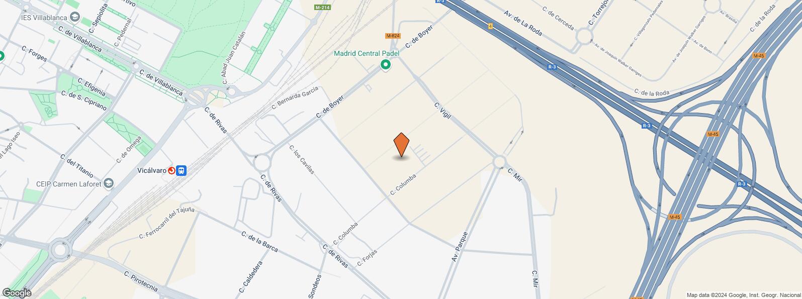
Location in a business and industrial area of Vicalvaro located at the foot of the R-3 and M-45. Good communications by public transport and easy accessibility by public transport through suburban areas (Vicalvaro station) and bus (line T23).
Location map
Map loading...Contact
Transport
| Bus | Line | Distance |
|---|---|---|
| Rivas-Columba | T23 | 440 m |
| Av.Del Parque-Transformador | T23 | 460 m |
| Rivas-Sondeos | T23 | 463 m |
| Rivas-Boyer | T23 | 488 m |
| Underground | Line | Distance |
|---|---|---|
| Puerta de Arganda | 9 | 876 m |
| Interurban bus | Line | Distance |
|---|---|---|
| Velilla de San Antonio - Boyer - Ctra. Coslada | N203 | 282 m |
| Madrid - Boyer - Ctra. Vicálvaro | 287, N203 | 302 m |
| Commuter train | Line | Distance |
|---|---|---|
| Vicálvaro | C1, C2, C7 | 805 m |
| Santa Eugenia | C1, C2, C7 | 3 km |
| Transport Node | Distance |
|---|---|
| Área Intermodal de Alsacia | 4 km |
| Aeropuerto Adolfo Suárez-Madrid Barajas | 7 km |
| Estación de Atocha Renfe | 9 km |
| Estación de Madrid-Chamartín | 11 km |
Points of interest
| Commercial areas | Distance |
|---|---|
| Mercado Municipal de Vicálvaro | 2 km |
| C.C. Valdebernardo | 3 km |
| Mercado Municipal de Santa Eugenia | 3 km |
| C.C. Zocoslada | 3 km |
| Hotels | Distance |
|---|---|
| Hotel - Apto. Encasa Vicálvaro *** | 498 m |
| Public Administration | Distance |
|---|---|
| Junta Municipal de Distrito. Vicálvaro | 2 km |
| Administración de la Agencia Tributaria Villa Vallecas | 3 km |
| Ayuntamiento de Coslada | 3 km |
| Protection and security | Distance |
|---|---|
| Policía Municipal (OAC) Vicálvaro | 1 km |
| Base de socorro de la Cruz Roja de Coslada. Calle Océano Pacífico, 3 | 3 km |
| Other points of interest | Distance |
|---|---|
| Gasolinera Carretera M-214 Vicálvaro-Rivas del Jarama, km. 4'600 | 459 m |
| Farmacia Avenida de la Gran Vía del Este 16-18, Madrid | 947 m |
Other properties in the Roble 21 Inmobiliaria portfolio
- Avenida Manoteras, 38Hortaleza, Madrid 28050Office for rent58 - 251 m2 | Floors 1 - 510.83 - 12.33 €/m2/mo | 650 - 2,850 €/mo

Vicálvaro
Vicálvaro
The Vicálvaro District covers an area of 3,271.50 hectares and is located at the southeast of Madrid. It borders to the west with the Moratalaz District, to the north with San Blas - Canillejas, to the south with Puente de Vallecas and Villa de Vallecas, and to the east with Coslada, San Fernando de Henares and Rivas-Vaciamadrid. The Rey Juan Carlos University has its Madrid campus in the Vicálvaro District.
Local call rate
Popular searches
- Shops in Madrid
- Shops for rent in Madrid
- Warehouse for rent in Madrid
- Offices for rent in Madrid
- Shops for sale in Madrid
- Shops in Madrid city center
- Shops for rent in Alcalá de Henares
- Shops for rent in Leganes
- Shops for rent in Mostoles
- Offices for sale in Madrid
- Warehouse for sale in Madrid
- Warehouses in Madrid
Other relevant searches
- San Blas - Canillejas land spaces for sale
- Villa de Vallecas land spaces for sale
- Puente de Vallecas land spaces for sale
- Casco Historico de Vallecas land spaces for sale
- Ensanche de Vallecas land spaces for sale
- El Cañaveral land spaces for sale
- Calle Pirotecnia land spaces for sale
- Calle Dehesa Vieja land spaces for sale


